Tumsar night lights from space
Night Light of Tumsar (Maharashtra) from space (India) Src. Average luminocity for 10x10km area is 14.4583% and for 50x50km: 5.579%.
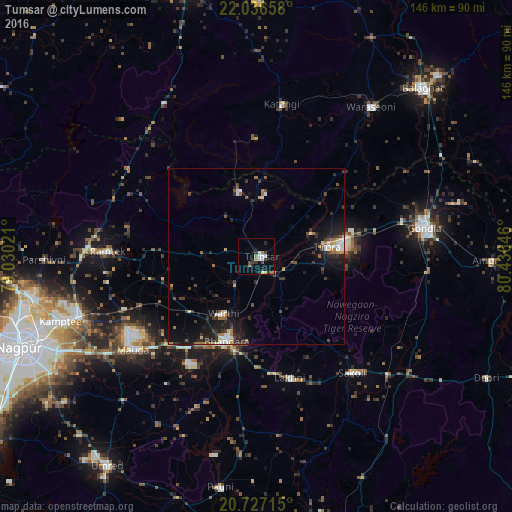
Analysis of Tumsar night lights 2016
Square area 10x10 km:
 1.14%
1.14%90-99
4.17%80-89
0%70-79
1.52%60-69
1.89%50-59
1.52%40-49
0.95%30-39
4.55%20-29
3.79%10-19
2.65%0-9
77.84%Square area 50x50 km:
0.61%90-99
0.84%80-89
0.33%70-79
0.31%60-69
0.85%50-59
0.56%40-49
0.91%30-39
1.44%20-29
1.65%10-19
4.73%0-9
87.77%Clear (daylight) street map image can be seen on geolist.org.
Map coordinates:
22° 2' 11.7" North, 79° 1' 48.8" East
21° 22' 60" North, 79° 43' 60" East
20° 43' 37.7" North, 80° 26' 11.3" East
Some cities around Tumsar sort by population:
• Gondiā
48.2 km =30 mi,  79°
79°
• Bhandāra
25.5 km =15.8 mi,  200°
200°
• Rāmtek
42.1 km =26.2 mi,  271°
271°
• Chicholi
10.1 km =6.3 mi,  340°
340°
• Katangi
44 km =27.3 mi,  9°
9°
• Tirodi
33.6 km =20.9 mi,  357°
357°
• Kāndri
47.5 km =29.5 mi, 274°
• Hīrāpur Hamesha
19.9 km =12.4 mi,  15°
15°
1254080 (p: 43,218)
Sources (retrieved 2019-11-25):
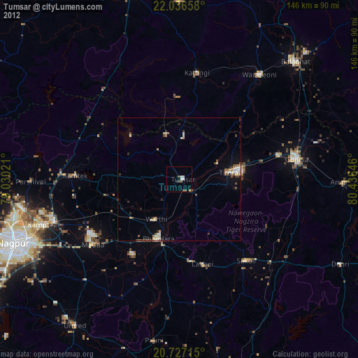
» Earth at Night: Flat Maps 2012, 2016