Chicholi night lights from space
Night Light of Chicholi (Maharashtra) from space (India) Src. Average luminocity for 10x10km area is 0.625% and for 50x50km: 3.1079%.
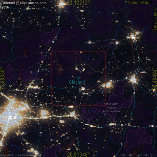
Analysis of Chicholi night lights 2016
Square area 10x10 km:
 0%
0%90-99
0%80-89
0%70-79
0%60-69
0%50-59
0%40-49
0%30-39
0%20-29
0.76%10-19
0%0-9
99.24%Square area 50x50 km:
0.18%90-99
0.42%80-89
0.14%70-79
0.22%60-69
0.47%50-59
0.39%40-49
0.77%30-39
0.85%20-29
0.85%10-19
1.64%0-9
94.07%Clear (daylight) street map image can be seen on geolist.org.
Map coordinates:
22° 7' 19.6" North, 78° 59' 54.2" East
21° 28' 9.3" North, 79° 42' 5.4" East
20° 48' 48.5" North, 80° 24' 16.7" East
Some cities around Chicholi sort by population:
• Bhandāra
33.9 km =21.1 mi,  189°
189°
• Tumsar
10.1 km =6.3 mi,  160°
160°
• Rāmtek
39.6 km =24.6 mi,  258°
258°
• Katangi
35.5 km =22.1 mi,  17°
17°
• Tirodi
24.1 km =15 mi,  4°
4°
• Kāndri
44.3 km =27.5 mi, 262°
• Mansar
46.1 km =28.6 mi, 259°
• Hīrāpur Hamesha
13 km =8.1 mi,  42°
42°
1274265 (p: 18,864)
Sources (retrieved 2019-11-25):
» Earth at Night: Flat Maps 2012, 2016