Thanniyam night lights from space
Night Light of Thanniyam (Kerala) from space (India) Src. Average luminocity for 10x10km area is 1.4731% and for 50x50km: 6.8559%.
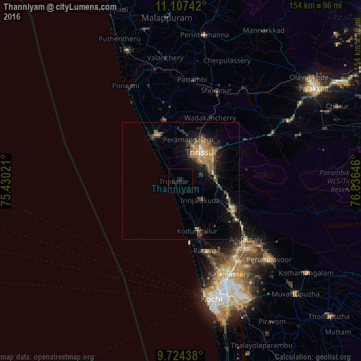
Analysis of Thanniyam night lights 2016
Square area 10x10 km:
 0%
0%90-99
0%80-89
0%70-79
0%60-69
0%50-59
0%40-49
0%30-39
0.83%20-29
0%10-19
4.96%0-9
94.21%Square area 50x50 km:
0.08%90-99
0.4%80-89
0.55%70-79
1.84%60-69
0.98%50-59
1.48%40-49
1.45%30-39
1.81%20-29
1.7%10-19
4.74%0-9
84.97%Clear (daylight) street map image can be seen on geolist.org.
Map coordinates:
11° 6' 26.7" North, 75° 25' 48.8" East
10° 25' 0" North, 76° 7' 60" East
9° 43' 27.8" North, 76° 50' 11.3" East
Some cities around Thanniyam sort by population:
• Thrissur
14.4 km =8.9 mi,  39°
39°
• Kunnamkulam
26.6 km =16.5 mi,  344°
344°
• Kizhake Chālakudi
25.8 km =16 mi,  119°
119°
• Chetwayi
15.6 km =9.7 mi,  323°
323°
• Angamāli
37.5 km =23.3 mi,  132°
132°
• Kodungallūr
21.6 km =13.4 mi,  161°
161°
• Irinjālakuda
11.9 km =7.4 mi, 134°
• Guruvāyūr
22.2 km =13.8 mi,  332°
332°
1254645 (p: 8,449)
Sources (retrieved 2019-11-25):
» Earth at Night: Flat Maps 2012, 2016