Sūratgarh night lights from space
Night Light of Sūratgarh (Rajasthan) from space (India) Src. Average luminocity for 10x10km area is 20.6686% and for 50x50km: 3.1239%.
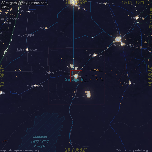
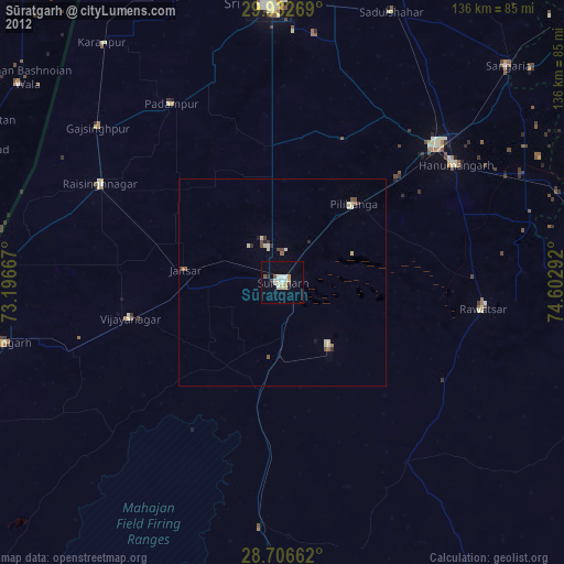
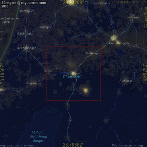
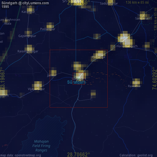
Analysis of Sūratgarh night lights 2016
Square area 10x10 km:
 2.46%
2.46%90-99
6.63%80-89
1.52%70-79
1.52%60-69
1.7%50-59
1.14%40-49
1.52%30-39
0.19%20-29
1.89%10-19
28.03%0-9
53.41%Square area 50x50 km:
0.24%90-99
0.93%80-89
0.35%70-79
0.15%60-69
0.37%50-59
0.25%40-49
0.4%30-39
0.26%20-29
0.16%10-19
2.25%0-9
94.64%Clear (daylight) street map image can be seen on geolist.org.
Map coordinates:
29° 55' 57.7" North, 73° 11' 48" East
29° 19' 17.4" North, 73° 53' 59.2" East
28° 42' 23.8" North, 74° 36' 10.5" East
Some cities around Sūratgarh sort by population:
• Gangānagar
66.6 km =41.4 mi,  357°
357°
• Hanumāngarh
50.7 km =31.5 mi,  55°
55°
• Pilibangan
24.1 km =15 mi,  53°
53°
• Anūpgarh
68.6 km =42.6 mi,  257°
257°
• Rāwatsār
49.2 km =30.6 mi,  97°
97°
• Rāisinghnagar
49.7 km =30.9 mi,  298°
298°
• Karanpur
72 km =44.7 mi,  323°
323°
• Padampur
50.6 km =31.4 mi,  328°
328°
1255361 (p: 63,153)
Sources (retrieved 2019-11-25):
» NASA, Earths city lights 1995
» NASA city lights 2003
» Earth at Night: Flat Maps 2012, 2016