Suchindram night lights from space
Night Light of Suchindram (Tamil Nadu) from space (India) Src. Average luminocity for 10x10km area is 58.1508% and for 50x50km: 13.2296%.
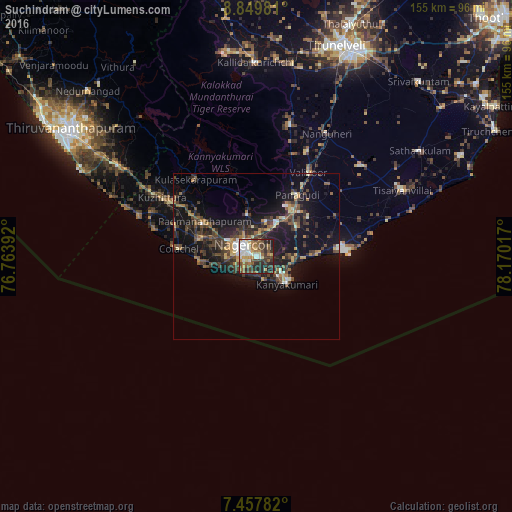
Analysis of Suchindram night lights 2016
Square area 10x10 km:
 10.54%
90-99
12.4%80-89
5.37%70-79
6.4%60-69
10.95%50-59
9.5%40-49
10.54%30-39
14.26%20-29
16.74%10-19
3.31%0-9
0%Square area 50x50 km:
0.83%90-99
1.35%80-89
0.98%70-79
1.39%60-69
1.99%50-59
1.97%40-49
3.73%30-39
3.86%20-29
4.32%10-19
12.97%0-9
66.62%Clear (daylight) street map image can be seen on geolist.org.
Map coordinates:
8° 50' 59.3" North, 76° 45' 50.1" East
8° 9' 15.9" North, 77° 28' 1.3" East
7° 27' 28.2" North, 78° 10' 12.6" East
Some cities around Suchindram sort by population:
• Nāgercoil
4.7 km =2.9 mi,  305°
305°
• Vadakku Valliyūr
30 km =18.6 mi,  32°
32°
• Colachel
23.2 km =14.4 mi,  276°
276°
• Kuzhithurai
35.3 km =21.9 mi,  300°
300°
• Kanniyākumāri
10.6 km =6.6 mi,  132°
132°
• Padmanābhapuram
18.5 km =11.5 mi, 302°
• Manavālakurichi
17.8 km =11.1 mi,  267°
267°
• Eraniel
17.4 km =10.8 mi,  289°
289°
1255584 (p: 12,316)
Sources (retrieved 2019-11-25):
» Earth at Night: Flat Maps 2012, 2016