Solāpur night lights from space
Night Light of Solāpur (Maharashtra) from space (India) Src. Average luminocity for 10x10km area is 93.0806% and for 50x50km: 17.7999%.
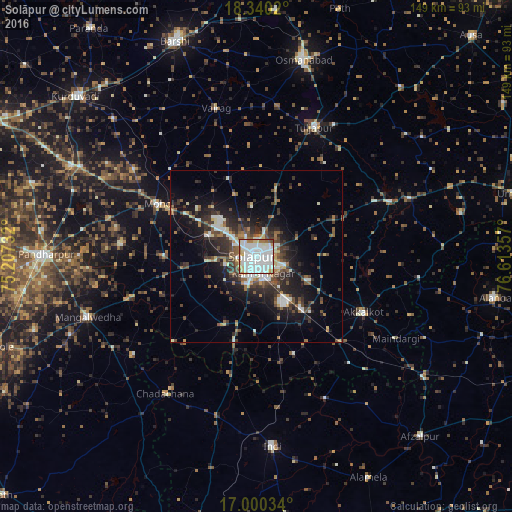
Analysis of Solāpur night lights 2016
Square area 10x10 km:
 48.97%
90-99
30.37%80-89
7.02%70-79
2.48%60-69
7.64%50-59
2.07%40-49
1.45%30-39
0%20-29
0%10-19
0%0-9
0%Square area 50x50 km:
3.18%90-99
3.35%80-89
1.33%70-79
1.15%60-69
1.94%50-59
2.52%40-49
2.86%30-39
3.61%20-29
5.95%10-19
10.81%0-9
63.3%Clear (daylight) street map image can be seen on geolist.org.
Map coordinates:
18° 20' 24.7" North, 75° 12' 26.4" East
17° 40' 17.5" North, 75° 54' 37.6" East
17° 0' 1.2" North, 76° 36' 48.9" East
Some cities around Solāpur sort by population:
• Osmanabad
58.3 km =36.2 mi,  13°
13°
• Akalkot
35.3 km =21.9 mi,  117°
117°
• Tuljāpur
41.1 km =25.5 mi,  24°
24°
• Indi
55.1 km =34.2 mi,  175°
175°
• Naldurg
42.5 km =26.4 mi,  67°
67°
• Dudhani
59.7 km =37.1 mi,  125°
125°
• Kāti
32.3 km =20.1 mi,  355°
355°
• Maindargi
47 km =29.2 mi, 120°
1256436 (p: 997,281)
Sources (retrieved 2019-11-25):
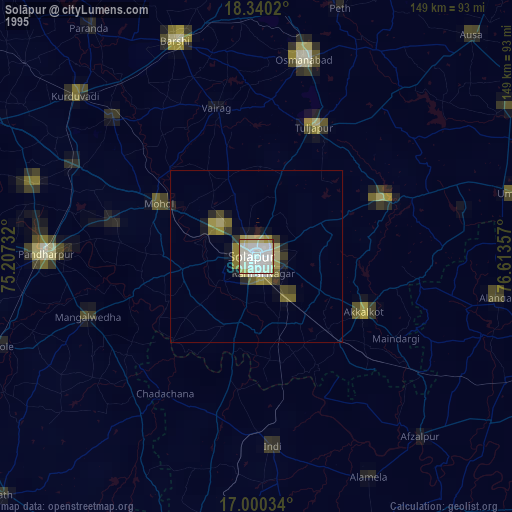
» NASA, Earths city lights 1995
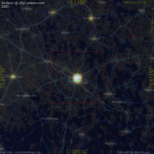
» NASA city lights 2003
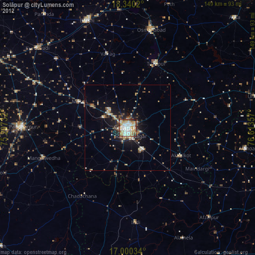
» Earth at Night: Flat Maps 2012, 2016