Kāti night lights from space
Night Light of Kāti (Maharashtra) from space (India) Src. Average luminocity for 10x10km area is 2.3615% and for 50x50km: 7.6987%.
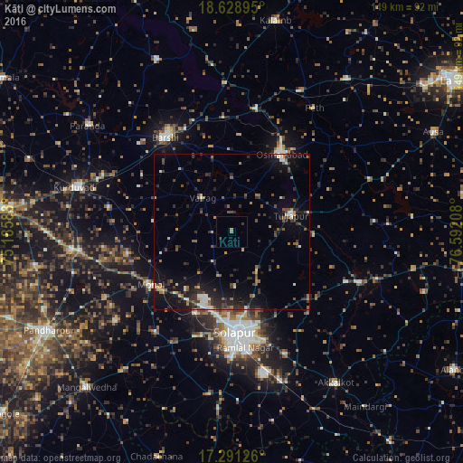
Analysis of Kāti night lights 2016
Square area 10x10 km:
 0%
0%90-99
0%80-89
0%70-79
0.65%60-69
0.87%50-59
0.22%40-49
0%30-39
0.87%20-29
0.87%10-19
0%0-9
96.54%Square area 50x50 km:
0.46%90-99
0.84%80-89
0.56%70-79
0.73%60-69
0.84%50-59
1.32%40-49
1.34%30-39
2.12%20-29
3.06%10-19
5.68%0-9
83.04%Clear (daylight) street map image can be seen on geolist.org.
Map coordinates:
18° 37' 44.2" North, 75° 11' 9" East
17° 57' 40.9" North, 75° 53' 20.2" East
17° 17' 28.5" North, 76° 35' 31.5" East
Some cities around Kāti sort by population:
• Solāpur
32.3 km =20.1 mi,  175°
175°
• Bārsi
36.8 km =22.9 mi,  325°
325°
• Osmanabad
29.2 km =18.1 mi,  32°
32°
• Akalkot
59 km =36.7 mi,  145°
145°
• Tuljāpur
19.8 km =12.3 mi,  74°
74°
• Kurduvādi
52.1 km =32.4 mi,  286°
286°
• Bhūm
60.4 km =37.5 mi,  336°
336°
• Naldurg
44.6 km =27.7 mi,  111°
111°
1267481 (p: 12,022)
Sources (retrieved 2019-11-25):
» Earth at Night: Flat Maps 2012, 2016