Shāmgarh night lights from space
Night Light of Shāmgarh (Madhya Pradesh) from space (India) Src. Average luminocity for 10x10km area is 8.233% and for 50x50km: 4.0661%.
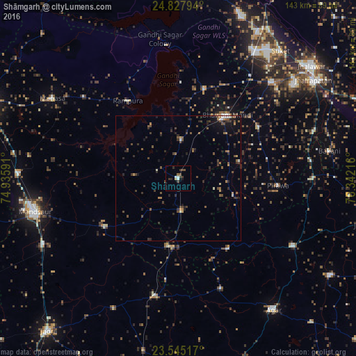
Analysis of Shāmgarh night lights 2016
Square area 10x10 km:
 0.19%
0.19%90-99
2.08%80-89
0.76%70-79
0%60-69
0.19%50-59
1.33%40-49
1.89%30-39
4.36%20-29
1.14%10-19
1.7%0-9
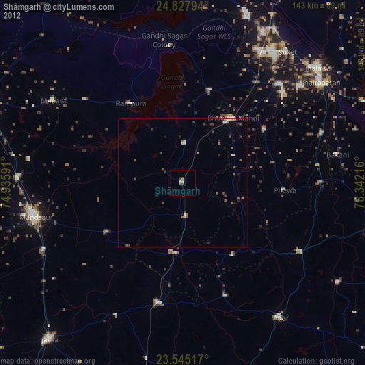
86.36%Square area 50x50 km:
0.13%90-99
0.35%80-89
0.15%70-79
0.42%60-69
0.42%50-59
0.99%40-49
1.15%30-39
1.33%20-29
1.15%10-19
2.16%0-9
91.76%Clear (daylight) street map image can be seen on geolist.org.
Map coordinates:
24° 49' 40.6" North, 74° 56' 9.3" East
24° 11' 17.4" North, 75° 38' 20.5" East
23° 32' 42.6" North, 76° 20' 31.8" East
Some cities around Shāmgarh sort by population:
• Bhawāniganj
32.2 km =20 mi,  38°
38°
• Alot
48 km =29.8 mi,  190°
190°
• Rāmpura
37 km =23 mi,  326°
326°
• Bhānpura
37.7 km =23.4 mi,  16°
16°
• Sunel
38.1 km =23.7 mi,  57°
57°
• Susner
52.9 km =32.9 mi,  120°
120°
• Sītāmau
34.8 km =21.6 mi,  236°
236°
• Pirāwa
39.6 km =24.6 mi,  95°
95°
1256673 (p: 23,075)
Sources (retrieved 2019-11-25):
» Earth at Night: Flat Maps 2012, 2016