Rāmpura night lights from space
Night Light of Rāmpura (Madhya Pradesh) from space (India) Src. Average luminocity for 10x10km area is 5.1964% and for 50x50km: 1.8997%.
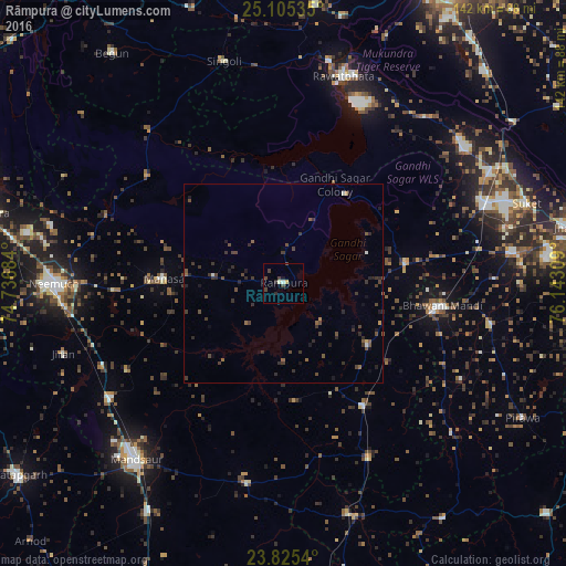
Analysis of Rāmpura night lights 2016
Square area 10x10 km:
 0%
0%90-99
1.59%80-89
0.6%70-79
0.2%60-69
0%50-59
0%40-49
3.17%30-39
1.19%20-29
1.59%10-19
0.79%0-9
90.87%Square area 50x50 km:
0.02%90-99
0.17%80-89
0.06%70-79
0.1%60-69
0.08%50-59
0.42%40-49
0.85%30-39
0.97%20-29
0.72%10-19
0.6%0-9
96.02%Clear (daylight) street map image can be seen on geolist.org.
Map coordinates:
25° 6' 19.3" North, 74° 44' 12.6" East
24° 28' 1.2" North, 75° 26' 23.9" East
23° 49' 31.4" North, 76° 8' 35.1" East
Some cities around Rāmpura sort by population:
• Bhawāniganj
40.4 km =25.1 mi,  98°
98°
• Manāsa
30.3 km =18.8 mi,  272°
272°
• Shāmgarh
37 km =23 mi,  146°
146°
• Bhānpura
31.5 km =19.6 mi,  80°
80°
• Sītāmau
51.1 km =31.8 mi,  189°
189°
• Nārāyangarh
45.1 km =28 mi,  241°
241°
• Malhārgarh
49.9 km =31 mi,  245°
245°
• Ratangarh
50.8 km =31.6 mi,  319°
319°
1258592 (p: 18,495)
Sources (retrieved 2019-11-25):
» Earth at Night: Flat Maps 2012, 2016