Sītāmau night lights from space
Night Light of Sītāmau (Madhya Pradesh) from space (India) Src. Average luminocity for 10x10km area is 7.4792% and for 50x50km: 1.9809%.
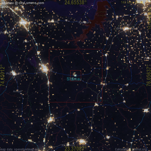
Analysis of Sītāmau night lights 2016
Square area 10x10 km:
 0%
0%90-99
1.52%80-89
0.76%70-79
1.52%60-69
0.95%50-59
0.57%40-49
1.52%30-39
2.08%20-29
2.08%10-19
1.89%0-9
87.12%Square area 50x50 km:
0%90-99
0.16%80-89
0.12%70-79
0.15%60-69
0.25%50-59
0.3%40-49
0.45%30-39
0.82%20-29
0.73%10-19
1.31%0-9
95.72%Clear (daylight) street map image can be seen on geolist.org.
Map coordinates:
24° 39' 19.4" North, 74° 39' 0.4" East
24° 0' 53" North, 75° 21' 11.7" East
23° 22' 15.1" North, 76° 3' 22.9" East
Some cities around Sītāmau sort by population:
• Mandsaur
29.5 km =18.3 mi,  282°
282°
• Jaorā
47.8 km =29.7 mi,  208°
208°
• Alot
34.8 km =21.6 mi,  143°
143°
• Shāmgarh
34.8 km =21.6 mi,  56°
56°
• Rāmpura
51.1 km =31.8 mi,  9°
9°
• Tāl
33 km =20.5 mi,  174°
174°
• Nārāyangarh
41.9 km =26 mi,  312°
312°
• Malhārgarh
47.4 km =29.5 mi, 308°
1255981 (p: 13,441)
Sources (retrieved 2019-11-25):
» Earth at Night: Flat Maps 2012, 2016