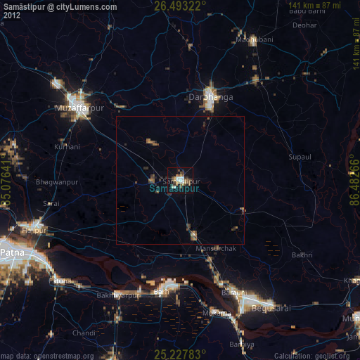
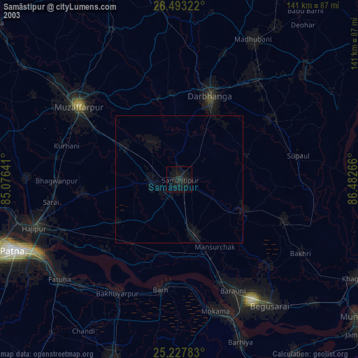
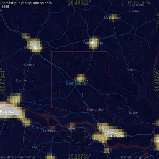
Samāstipur night lights from space
Night Light of Samāstipur (Bihar) from space (India) Src. Average luminocity for 10x10km area is 74.303% and for 50x50km: 31.9285%.
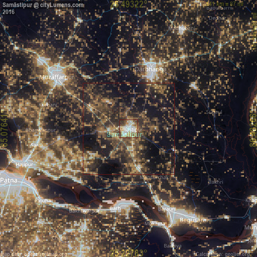
Analysis of Samāstipur night lights 2016
Square area 10x10 km:
 16.1%
16.1%90-99
21.4%80-89
13.83%70-79
9.09%60-69
6.44%50-59
13.26%40-49
10.8%30-39
7.39%20-29
1.7%10-19
0%0-9
0%Square area 50x50 km:
1.03%90-99
2.13%80-89
2.35%70-79
3.3%60-69
5.26%50-59
7.59%40-49
11.09%30-39
12.4%20-29
14.03%10-19
23.53%0-9
17.28%Clear (daylight) street map image can be seen on geolist.org.
Map coordinates:
26° 29' 35.6" North, 85° 4' 35.1" East
25° 51' 44" North, 85° 46' 46.3" East
25° 13' 40.2" North, 86° 28' 57.6" East
Some cities around Samāstipur sort by population:
• Muzaffarpur
48.5 km =30.1 mi,  306°
306°
• Darbhanga
34.3 km =21.3 mi,  20°
20°
• Bāruni
47 km =29.2 mi,  156°
156°
• Bārh
42.7 km =26.5 mi,  189°
189°
• Teghra
44.4 km =27.6 mi, 158°
• Rusera
27.5 km =17.1 mi,  116°
116°
• Dalsingh Sarai
22.3 km =13.9 mi,  165°
165°
• Mohiuddinnagar
33.9 km =21.1 mi,  198°
198°
1257551 (p: 57,575)
Sources (retrieved 2019-11-25):
» NASA, Earths city lights 1995
» NASA city lights 2003
» Earth at Night: Flat Maps 2012, 2016