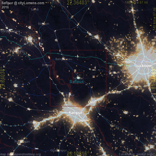
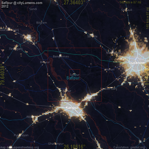
Safīpur night lights from space
Night Light of Safīpur (Uttar Pradesh) from space (India) Src. Average luminocity for 10x10km area is 8.4087% and for 50x50km: 9.0879%.
Analysis of Safīpur night lights 2016
Square area 10x10 km:
 1.19%
1.19%90-99
1.19%80-89
1.39%70-79
0.2%60-69
0.79%50-59
0%40-49
2.18%30-39
1.39%20-29
3.37%10-19
1.19%0-9
87.1%Square area 50x50 km:
0.93%90-99
2.07%80-89
0.9%70-79
0.9%60-69
1.13%50-59
1.05%40-49
1.49%30-39
1.75%20-29
3.23%10-19
5.23%0-9
81.32%Clear (daylight) street map image can be seen on geolist.org.
Map coordinates:
27° 21' 50.5" North, 79° 38' 25.4" East
26° 44' 16.2" North, 80° 20' 36.6" East
26° 6' 29.4" North, 81° 2' 47.9" East
Some cities around Safīpur sort by population:
• Unnāo
25.6 km =15.9 mi,  145°
145°
• Bāngarmau
21.5 km =13.4 mi,  322°
322°
• Jagdīshpur
20.1 km =12.5 mi,  86°
86°
• Bithūr
16.3 km =10.1 mi,  206°
206°
• Rasūlābād
14.6 km =9.1 mi, 86°
• Aurās
25.5 km =15.8 mi,  39°
39°
• Ugu
6.9 km =4.3 mi,  341°
341°
• Fatehpur Chaurāsi
9.6 km =6 mi,  306°
306°
1257854 (p: 24,801)
Sources (retrieved 2019-11-25):
» Earth at Night: Flat Maps 2012, 2016