Jagdīshpur night lights from space
Night Light of Jagdīshpur (Uttar Pradesh) from space (India) Src. Average luminocity for 10x10km area is 2.7063% and for 50x50km: 15.0136%.
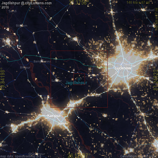
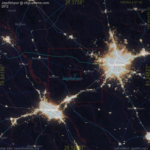
Analysis of Jagdīshpur night lights 2016
Square area 10x10 km:
 0%
0%90-99
0%80-89
0%70-79
0%60-69
0%50-59
1.59%40-49
0%30-39
0.99%20-29
2.38%10-19
1.19%0-9
93.85%Square area 50x50 km:
1.04%90-99
2.33%80-89
1.46%70-79
1.89%60-69
1.72%50-59
2.83%40-49
3.48%30-39
3.39%20-29
5.42%10-19
9.32%0-9
67.11%Clear (daylight) street map image can be seen on geolist.org.
Map coordinates:
27° 22' 32.9" North, 79° 50' 31.1" East
26° 44' 58.8" North, 80° 32' 42.4" East
26° 7' 12.3" North, 81° 14' 53.6" East
Some cities around Jagdīshpur sort by population:
• Unnāo
23.2 km =14.4 mi,  194°
194°
• Safīpur
20.1 km =12.5 mi,  266°
266°
• Kākori
27.3 km =17 mi,  61°
61°
• Malīhābād
25.3 km =15.7 mi,  40°
40°
• Mohān
13.3 km =8.3 mi,  75°
75°
• Rasūlābād
5.5 km =3.4 mi,  264°
264°
• Aurās
18.7 km =11.6 mi,  348°
348°
• Ugu
22.9 km =14.2 mi,  283°
283°
1269574 (p: 31,029)
Sources (retrieved 2019-11-25):
» Earth at Night: Flat Maps 2012, 2016