Rānāvāv night lights from space
Night Light of Rānāvāv (Gujarat) from space (India) Src. Average luminocity for 10x10km area is 20.0133% and for 50x50km: 5.6086%.
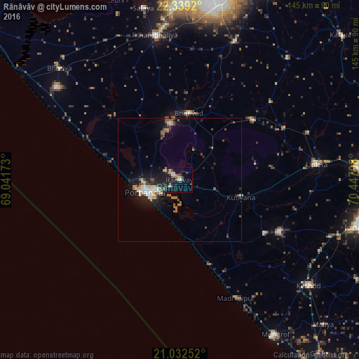
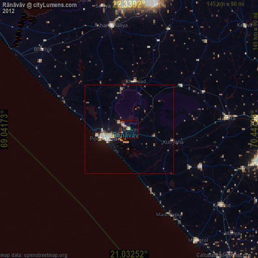
Analysis of Rānāvāv night lights 2016
Square area 10x10 km:
 1.14%
1.14%90-99
3.41%80-89
3.6%70-79
0.95%60-69
2.27%50-59
3.22%40-49
4.73%30-39
3.41%20-29
0.57%10-19
24.05%0-9
52.65%Square area 50x50 km:
0.38%90-99
0.89%80-89
0.73%70-79
0.49%60-69
0.93%50-59
0.73%40-49
0.88%30-39
0.7%20-29
1.46%10-19
5.13%0-9
87.67%Clear (daylight) street map image can be seen on geolist.org.
Map coordinates:
22° 20' 21.1" North, 69° 2' 30.2" East
21° 41' 14.4" North, 69° 44' 41.5" East
21° 1' 57.1" North, 70° 26' 52.7" East
Some cities around Rānāvāv sort by population:
• Porbandar
14.9 km =9.3 mi,  250°
250°
• Upleta
55.9 km =34.7 mi,  83°
83°
• Jodhpur
38.1 km =23.7 mi,  51°
51°
• Mānāvadar
45.7 km =28.4 mi,  117°
117°
• Bhānvad
27.3 km =17 mi,  7°
7°
• Bhāyāvadar
55.2 km =34.3 mi,  70°
70°
• Kutiyāna
25.8 km =16 mi,  105°
105°
• Bāntva
40.8 km =25.4 mi, 122°
1258534 (p: 26,011)
Sources (retrieved 2019-11-25):
» Earth at Night: Flat Maps 2012, 2016