Rāmgarh night lights from space
Night Light of Rāmgarh (Jharkhand) from space (India) Src. Average luminocity for 10x10km area is 80.619% and for 50x50km: 42.8349%.

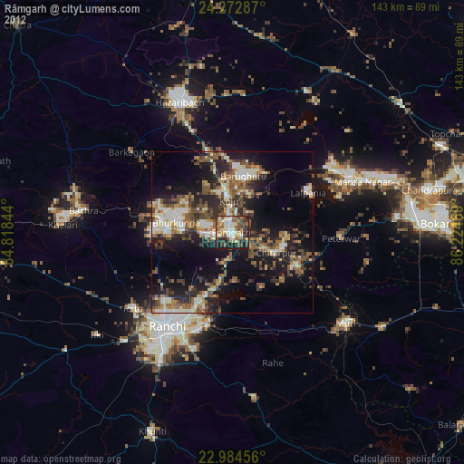
Analysis of Rāmgarh night lights 2016
Square area 10x10 km:
 24.6%
24.6%90-99
25.4%80-89
9.52%70-79
8.73%60-69
10.71%50-59
9.72%40-49
6.35%30-39
4.96%20-29
0%10-19
0%0-9
0%Square area 50x50 km:
8.11%90-99
9.4%80-89
3.91%70-79
4.26%60-69
6.07%50-59
7.78%40-49
7.03%30-39
7.65%20-29
10.34%10-19
13.37%0-9
22.07%Clear (daylight) street map image can be seen on geolist.org.
Map coordinates:
24° 16' 22.3" North, 84° 49' 6.4" East
23° 37' 49.1" North, 85° 31' 17.6" East
22° 59' 4.4" North, 86° 13' 28.9" East
Some cities around Rāmgarh sort by population:
• Ranchi
38.6 km =24 mi,  214°
214°
• Bokāro
47.6 km =29.6 mi,  68°
68°
• Hazāribāgh
43.4 km =27 mi,  337°
337°
• Gumia
36.1 km =22.4 mi,  58°
58°
• Kuju
10.6 km =6.6 mi,  353°
353°
• Barkā Kānā
5.6 km =3.5 mi,  259°
259°
• Kānke
29.9 km =18.6 mi,  223°
223°
• Muri
45.2 km =28.1 mi,  129°
129°
1258686 (p: 83,833)
Sources (retrieved 2019-11-25):
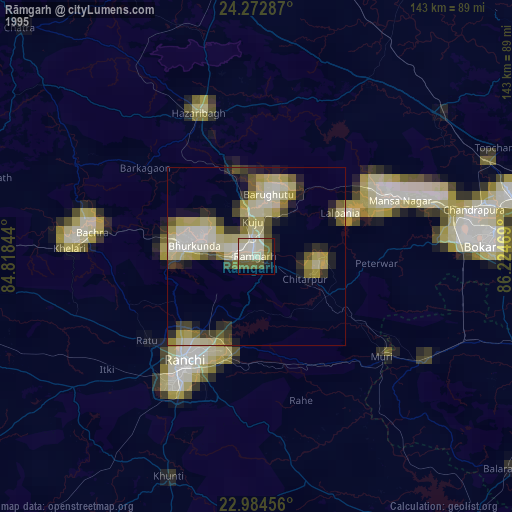
» NASA, Earths city lights 1995
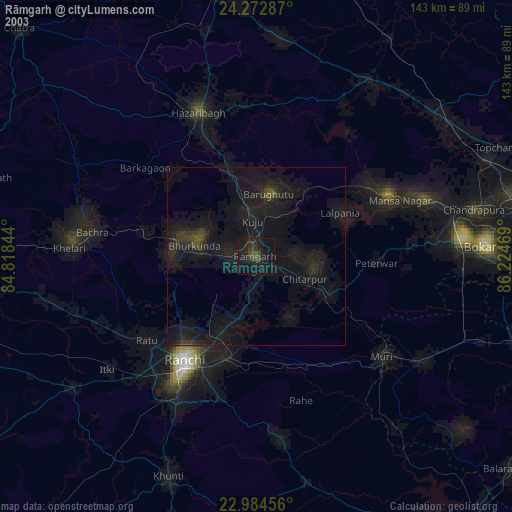
» NASA city lights 2003
» Earth at Night: Flat Maps 2012, 2016