Bokāro night lights from space
Night Light of Bokāro (Jharkhand) from space (India) Src. Average luminocity for 10x10km area is 71.8194% and for 50x50km: 36.8557%.
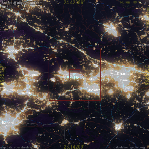
Analysis of Bokāro night lights 2016
Square area 10x10 km:
 25.79%
90-99
24.21%80-89
2.38%70-79
2.98%60-69
8.53%50-59
6.55%40-49
5.95%30-39
7.74%20-29
15.67%10-19
0.2%0-9
0%Square area 50x50 km:
8.3%90-99
6.69%80-89
3.56%70-79
3.41%60-69
4.83%50-59
5.2%40-49
5.72%30-39
7.18%20-29
9.23%10-19
15.82%0-9
30.06%Clear (daylight) street map image can be seen on geolist.org.
Map coordinates:
24° 25' 43.9" North, 85° 15' 12" East
23° 47' 13.5" North, 85° 57' 23.2" East
23° 8' 31.5" North, 86° 39' 34.5" East
Some cities around Bokāro sort by population:
• Chās
27.3 km =17 mi,  128°
128°
• Kātrās
34.8 km =21.6 mi,  88°
88°
• Gumia
13.4 km =8.3 mi,  274°
274°
• Gomoh
22.1 km =13.7 mi,  64°
64°
• Dugda
22.4 km =13.9 mi,  102°
102°
• Malkera
33.7 km =20.9 mi, 90°
• Hesla
31.7 km =19.7 mi,  345°
345°
• Topchānchi
27.8 km =17.3 mi, 62°
1275362 (p: 418,533)
Sources (retrieved 2019-11-25):
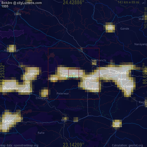
» NASA, Earths city lights 1995
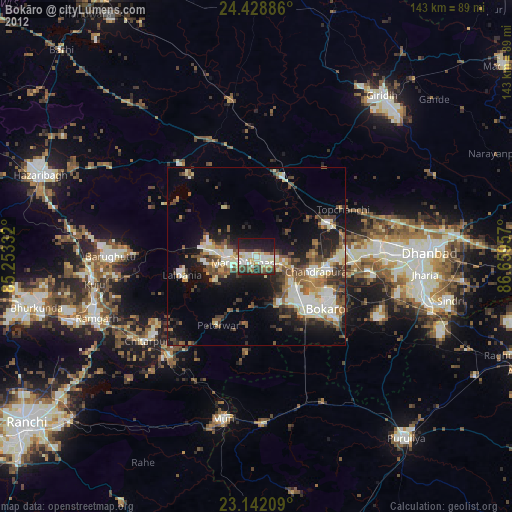
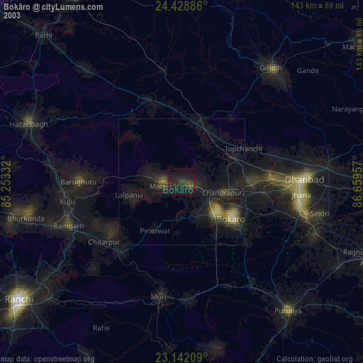
» NASA city lights 2003
» Earth at Night: Flat Maps 2012, 2016