Jharsuguda night lights from space
Night Light of Jharsuguda (Odisha) from space (India) Src. Average luminocity for 10x10km area is 87.0516% and for 50x50km: 27.5338%.
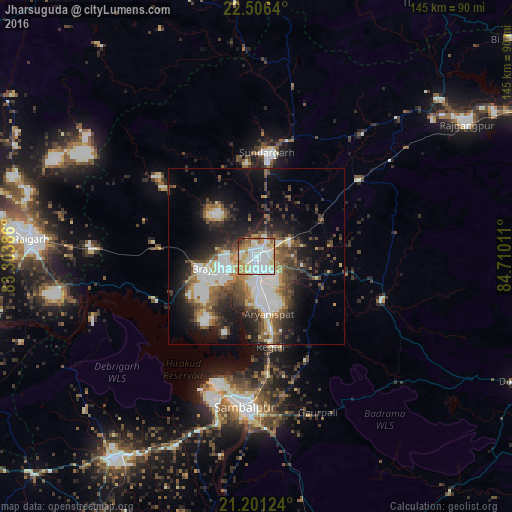
Analysis of Jharsuguda night lights 2016
Square area 10x10 km:
 28.57%
90-99
31.15%80-89
12.5%70-79
11.71%60-69
8.13%50-59
4.37%40-49
1.39%30-39
0.99%20-29
1.19%10-19
0%0-9
0%Square area 50x50 km:
5.58%90-99
5.66%80-89
2.22%70-79
2.38%60-69
3.15%50-59
4.42%40-49
4.91%30-39
4.39%20-29
6.98%10-19
12.91%0-9
47.41%Clear (daylight) street map image can be seen on geolist.org.
Map coordinates:
22° 30' 23" North, 83° 18' 13.9" East
21° 51' 19.1" North, 84° 0' 25.1" East
21° 12' 4.5" North, 84° 42' 36.4" East
Some cities around Jharsuguda sort by population:
• Sambalpur
43.5 km =27 mi,  184°
184°
• Raigarh
63.2 km =39.3 mi,  274°
274°
• Brājarājnagar
10.3 km =6.4 mi,  245°
245°
• Sundargarh
29.2 km =18.1 mi,  5°
5°
• Burla
40.9 km =25.4 mi,  199°
199°
• Hīrākud
39.3 km =24.4 mi, 200°
• Kuchinda
37.4 km =23.2 mi,  109°
109°
• Rengāli
23.8 km =14.8 mi,  168°
168°
1268977 (p: 79,492)
Sources (retrieved 2019-11-25):
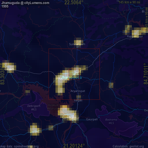
» NASA, Earths city lights 1995
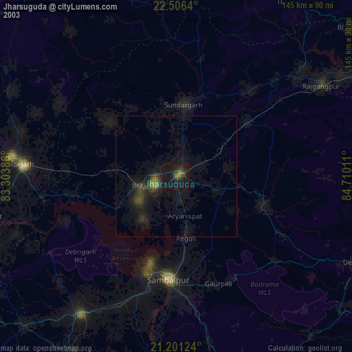
» NASA city lights 2003
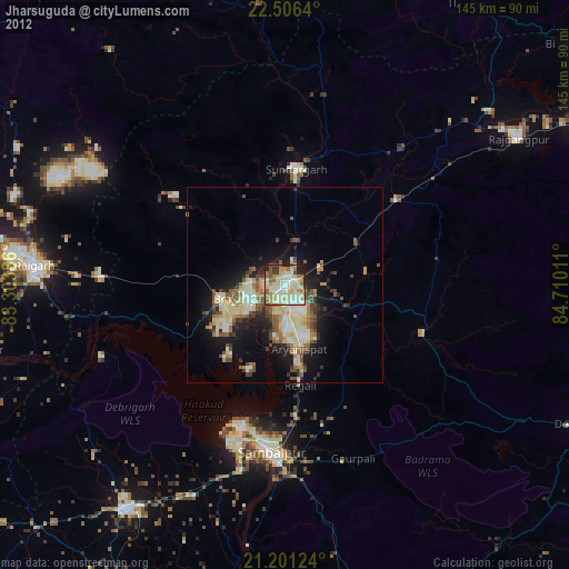
» Earth at Night: Flat Maps 2012, 2016