Punalūr night lights from space
Night Light of Punalūr (Kerala) from space (India) Src. Average luminocity for 10x10km area is 6.5671% and for 50x50km: 1.3437%.
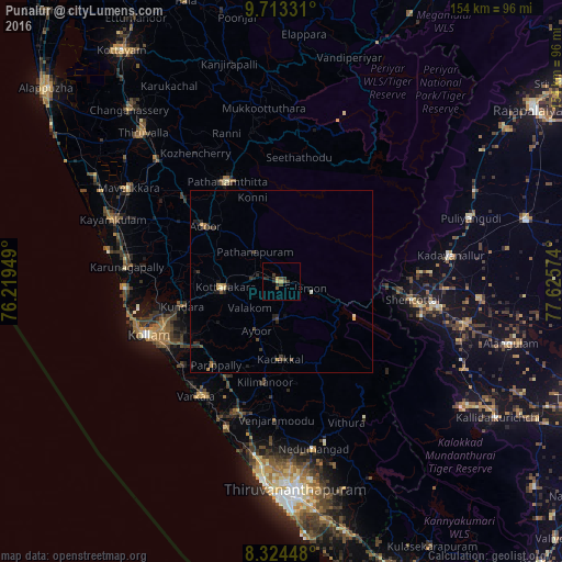
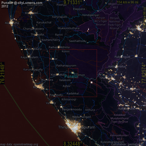
Analysis of Punalūr night lights 2016
Square area 10x10 km:
 0%
0%90-99
0%80-89
0.87%70-79
1.08%60-69
0.65%50-59
1.52%40-49
1.95%30-39
3.25%20-29
3.68%10-19
0%0-9
87.01%Square area 50x50 km:
0%90-99
0.08%80-89
0.19%70-79
0.19%60-69
0.2%50-59
0.08%40-49
0.32%30-39
0.52%20-29
0.74%10-19
0.36%0-9
97.33%Clear (daylight) street map image can be seen on geolist.org.
Map coordinates:
9° 42' 47.9" North, 76° 13' 10.2" East
9° 1' 10.4" North, 76° 55' 21.4" East
8° 19' 28.1" North, 77° 37' 32.7" East
Some cities around Punalūr sort by population:
• Kollam
40.2 km =25 mi,  247°
247°
• Varkala
39 km =24.2 mi,  215°
215°
• Paravūr Tekkumbhāgam
37.5 km =23.3 mi,  228°
228°
• Pathanāmthitta
31.4 km =19.5 mi,  330°
330°
• Vettūr
40 km =24.9 mi,  212°
212°
• Attingal
37.9 km =23.5 mi,  198°
198°
• Adūr
25.9 km =16.1 mi,  305°
305°
• Kadakkavoor
41.5 km =25.8 mi, 204°
1259243 (p: 47,263)
Sources (retrieved 2019-11-25):
» Earth at Night: Flat Maps 2012, 2016