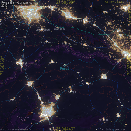
Porsa night lights from space
Night Light of Porsa (Madhya Pradesh) from space (India) Src. Average luminocity for 10x10km area is 23.25% and for 50x50km: 5.7381%.
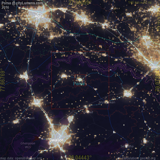
Analysis of Porsa night lights 2016
Square area 10x10 km:
 0.95%
0.95%90-99
3.41%80-89
2.46%70-79
2.84%60-69
1.89%50-59
0.76%40-49
8.14%30-39
7.77%20-29
8.14%10-19
17.42%0-9
46.21%Square area 50x50 km:
0.22%90-99
0.52%80-89
0.46%70-79
0.5%60-69
0.96%50-59
0.88%40-49
1.44%30-39
1.67%20-29
1.67%10-19
3.06%0-9
88.62%Clear (daylight) street map image can be seen on geolist.org.
Map coordinates:
27° 18' 3.6" North, 77° 40' 3.7" East
26° 40' 28" North, 78° 22' 14.9" East
26° 2' 39.9" North, 79° 4' 26.2" East
Some cities around Porsa sort by population:
• Morena
42.1 km =26.2 mi,  242°
242°
• Gohadi
27.8 km =17.3 mi,  165°
165°
• Ambāh
14.7 km =9.1 mi,  283°
283°
• Rājākhera
31.8 km =19.8 mi,  321°
321°
• Fatehābād
39.7 km =24.7 mi,  350°
350°
• Pināhat
23.4 km =14.5 mi,  1°
1°
• Mahgawān
31.5 km =19.6 mi,  129°
129°
• Bāh
31 km =19.3 mi,  45°
45°
1259388 (p: 37,824)
Sources (retrieved 2019-11-25):
» Earth at Night: Flat Maps 2012, 2016