Amalāpuram night lights from space
Night Light of Amalāpuram (Andhra Pradesh) from space (India) Src. Average luminocity for 10x10km area is 37.0043% and for 50x50km: 16.0104%.
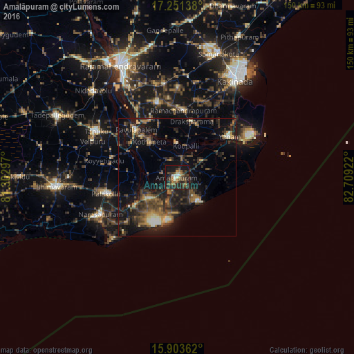
Analysis of Amalāpuram night lights 2016
Square area 10x10 km:
 0.65%
0.65%90-99
5.84%80-89
1.52%70-79
4.76%60-69
6.28%50-59
8.66%40-49
9.74%30-39
10.82%20-29
18.4%10-19
31.39%0-9
1.95%Square area 50x50 km:
0.4%90-99
1.84%80-89
1.13%70-79
1.54%60-69
2.5%50-59
2.84%40-49
4.29%30-39
4.05%20-29
6.9%10-19
15.86%0-9
58.65%Clear (daylight) street map image can be seen on geolist.org.
Map coordinates:
17° 15' 5" North, 81° 18' 10.7" East
16° 34' 43.2" North, 82° 0' 21.9" East
15° 54' 13" North, 82° 42' 33.2" East
Some cities around Amalāpuram sort by population:
• Tanuku
39.7 km =24.7 mi,  299°
299°
• Narasapur
36.5 km =22.7 mi,  243°
243°
• Pālakollu
30.2 km =18.8 mi,  256°
256°
• Mandapeta
32.6 km =20.3 mi,  345°
345°
• Rāmachandrapuram
28.8 km =17.9 mi,  4°
4°
• Yanam
28 km =17.4 mi,  52°
52°
• Penugonda
29 km =18 mi,  286°
286°
• Rāzole
21.1 km =13.1 mi, 237°
1278935 (p: 52,690)
Sources (retrieved 2019-11-25):
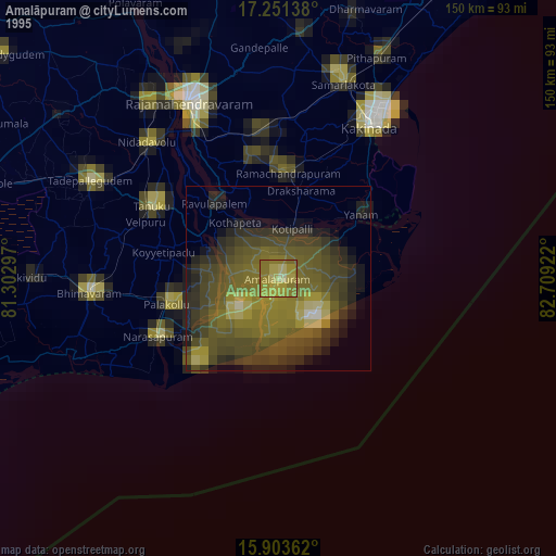
» NASA, Earths city lights 1995
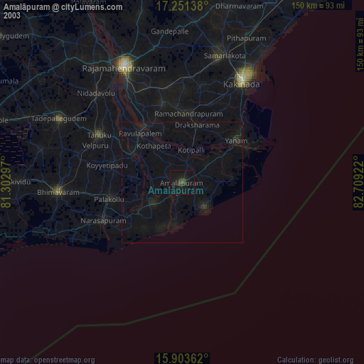
» NASA city lights 2003
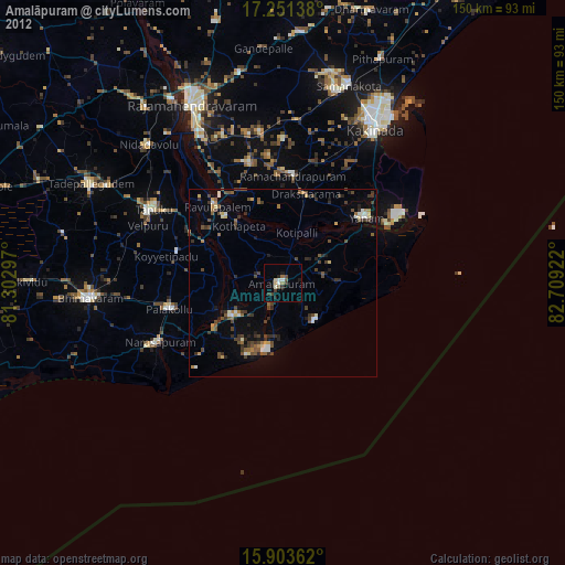
» Earth at Night: Flat Maps 2012, 2016