Pāsighāt night lights from space
Night Light of Pāsighāt (Arunachal Pradesh) from space (India) Src. Average luminocity for 10x10km area is 5.8958% and for 50x50km: 0.3484%.
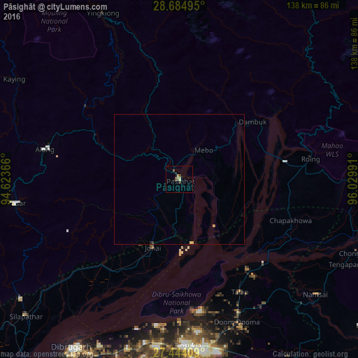
Analysis of Pāsighāt night lights 2016
Square area 10x10 km:
 0%
0%90-99
0.76%80-89
0.95%70-79
1.33%60-69
0%50-59
1.7%40-49
2.27%30-39
0.95%20-29
0.38%10-19
1.52%0-9
90.15%Square area 50x50 km:
0%90-99
0.03%80-89
0.04%70-79
0.14%60-69
0%50-59
0.07%40-49
0.12%30-39
0.04%20-29
0.03%10-19
0.08%0-9
99.45%Clear (daylight) street map image can be seen on geolist.org.
Map coordinates:
28° 41' 5.8" North, 94° 37' 25.2" East
28° 3' 58.7" North, 95° 19' 36.4" East
27° 26' 38.7" North, 96° 1' 47.7" East
Some cities around Pāsighāt sort by population:
• Dibrugarh
77.1 km =47.9 mi,  212°
212°
• Tinsukia
64.3 km =40 mi,  177°
177°
• Duliāgaon
77.2 km =48 mi, 181°
• Silapathar
79.2 km =49.2 mi,  228°
228°
• Dum Duma
59.8 km =37.2 mi,  157°
157°
• Along
52.9 km =32.9 mi,  282°
282°
• Mākum
65.4 km =40.6 mi,  170°
170°
• Chābua
66.6 km =41.4 mi,  192°
192°
1260206 (p: 25,581)
Sources (retrieved 2019-11-25):
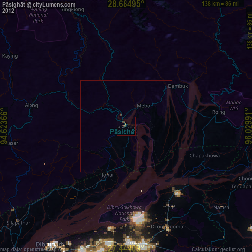
» Earth at Night: Flat Maps 2012, 2016