Dum Duma night lights from space
Night Light of Dum Duma (Assam) from space (India) Src. Average luminocity for 10x10km area is 17.5952% and for 50x50km: 13.6855%.
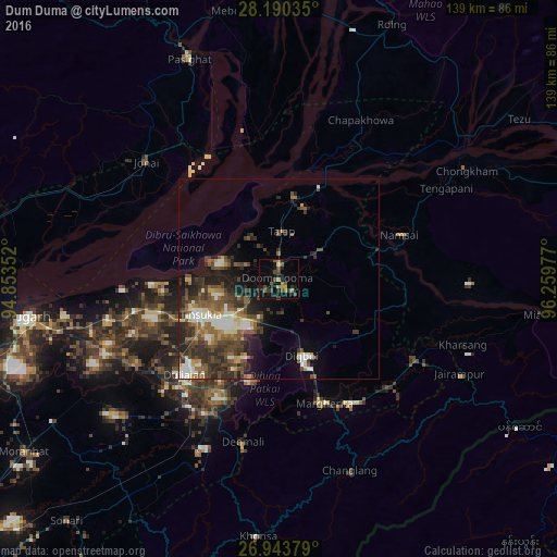
Analysis of Dum Duma night lights 2016
Square area 10x10 km:
 0%
0%90-99
0%80-89
1.39%70-79
2.18%60-69
4.96%50-59
3.17%40-49
5.56%30-39
2.98%20-29
5.16%10-19
13.69%0-9
60.91%Square area 50x50 km:
1.38%90-99
2.53%80-89
0.89%70-79
1.18%60-69
1.81%50-59
2.9%40-49
3.58%30-39
3.4%20-29
4.8%10-19
5.43%0-9
72.11%Clear (daylight) street map image can be seen on geolist.org.
Map coordinates:
28° 11' 25.3" North, 94° 51' 12.7" East
27° 34' 7.8" North, 95° 33' 23.9" East
26° 56' 37.6" North, 96° 15' 35.2" East
Some cities around Dum Duma sort by population:
• Tinsukia
21.3 km =13.2 mi,  245°
245°
• Margherita
33.4 km =20.8 mi,  160°
160°
• Duliāgaon
32.9 km =20.4 mi,  228°
228°
• Digboi
20.5 km =12.7 mi, 162°
• Nāmrup
47.8 km =29.7 mi,  209°
209°
• Mākum
15 km =9.3 mi, 232°
• Nahorkatiya
37.6 km =23.4 mi, 214°
• Chābua
38.9 km =24.2 mi,  255°
255°
1272242 (p: 21,706)
Sources (retrieved 2019-11-25):
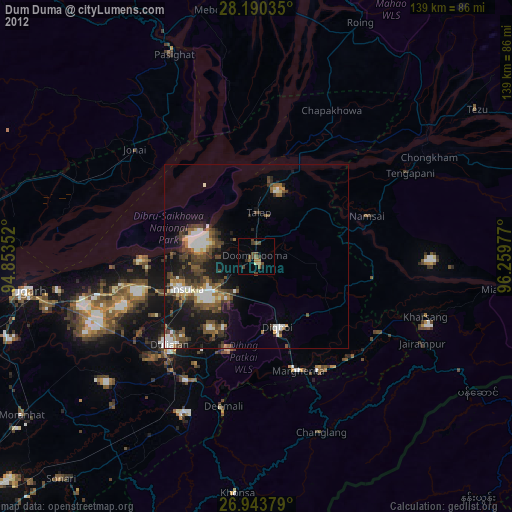
» Earth at Night: Flat Maps 2012, 2016