Dibrugarh night lights from space
Night Light of Dibrugarh (Assam) from space (India) Src. Average luminocity for 10x10km area is 39.0972% and for 50x50km: 10.506%.
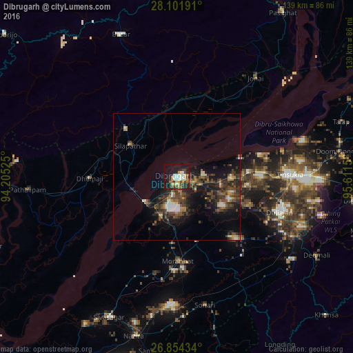
Analysis of Dibrugarh night lights 2016
Square area 10x10 km:
 2.38%
2.38%90-99
13.69%80-89
2.18%70-79
5.56%60-69
4.37%50-59
4.37%40-49
6.35%30-39
5.36%20-29
12.5%10-19
29.96%0-9
13.29%Square area 50x50 km:
0.7%90-99
1.52%80-89
0.56%70-79
1.12%60-69
1.13%50-59
1.9%40-49
2.77%30-39
3.39%20-29
4.31%10-19
8.04%0-9
74.57%Clear (daylight) street map image can be seen on geolist.org.
Map coordinates:
28° 6' 6.9" North, 94° 12' 18.9" East
27° 28' 47.6" North, 94° 54' 30.1" East
26° 51' 15.6" North, 95° 36' 41.4" East
Some cities around Dibrugarh sort by population:
• Tinsukia
44.6 km =27.7 mi,  88°
88°
• Duliāgaon
41.2 km =25.6 mi,  106°
106°
• Silapathar
22.2 km =13.8 mi,  305°
305°
• Nāmrup
51.6 km =32.1 mi,  128°
128°
• Nahorkatiya
47.8 km =29.7 mi,  116°
116°
• Dhemāji
32.1 km =19.9 mi,  270°
270°
• Chābua
26.3 km =16.3 mi, 89°
• Morānha
32.5 km =20.2 mi,  178°
178°
1272648 (p: 122,155)
Sources (retrieved 2019-11-25):
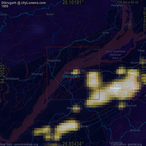
» NASA, Earths city lights 1995
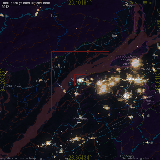
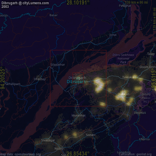
» NASA city lights 2003
» Earth at Night: Flat Maps 2012, 2016