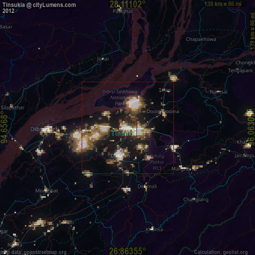
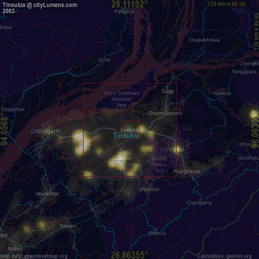
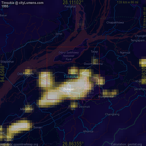
Tinsukia night lights from space
Night Light of Tinsukia (Assam) from space (India) Src. Average luminocity for 10x10km area is 66.3611% and for 50x50km: 22.3561%.
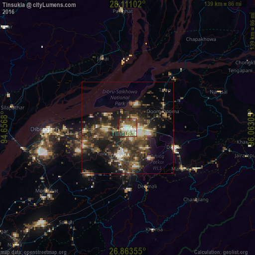
Analysis of Tinsukia night lights 2016
Square area 10x10 km:
 8.93%
8.93%90-99
21.43%80-89
4.96%70-79
5.95%60-69
13.1%50-59
19.64%40-49
8.73%30-39
9.92%20-29
7.14%10-19
0.2%0-9
0%Square area 50x50 km:
1.66%90-99
3.33%80-89
1.36%70-79
1.96%60-69
3.04%50-59
4.55%40-49
6.66%30-39
7.23%20-29
9.33%10-19
11.74%0-9
49.12%Clear (daylight) street map image can be seen on geolist.org.
Map coordinates:
28° 6' 39.7" North, 94° 39' 24.5" East
27° 29' 20.6" North, 95° 21' 35.7" East
26° 51' 48.8" North, 96° 3' 47" East
Some cities around Tinsukia sort by population:
• Margherita
38 km =23.6 mi,  126°
126°
• Duliāgaon
14 km =8.7 mi,  201°
201°
• Dum Duma
21.3 km =13.2 mi,  65°
65°
• Digboi
27.6 km =17.1 mi,  112°
112°
• Nāmrup
33.1 km =20.6 mi,  186°
186°
• Mākum
7.6 km =4.7 mi,  92°
92°
• Nahorkatiya
22.3 km =13.9 mi,  184°
184°
• Chābua
18.3 km =11.4 mi,  267°
267°
1254432 (p: 89,373)
Sources (retrieved 2019-11-25):
» NASA, Earths city lights 1995
» NASA city lights 2003
» Earth at Night: Flat Maps 2012, 2016