Silapathar night lights from space
Night Light of Silapathar (Assam) from space (India) Src. Average luminocity for 10x10km area is 2.6944% and for 50x50km: 4.1361%.
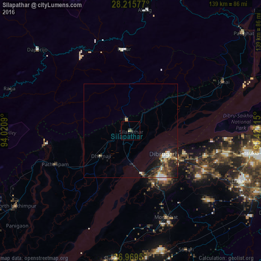
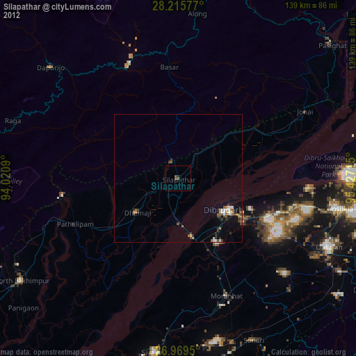
Analysis of Silapathar night lights 2016
Square area 10x10 km:
 0%
0%90-99
0%80-89
0.79%70-79
0%60-69
0.6%50-59
0.2%40-49
0.79%30-39
1.59%20-29
0%10-19
0.79%0-9
95.24%Square area 50x50 km:
0.31%90-99
0.9%80-89
0.18%70-79
0.54%60-69
0.54%50-59
0.47%40-49
1.11%30-39
0.91%20-29
1.79%10-19
2.66%0-9
90.6%Clear (daylight) street map image can be seen on geolist.org.
Map coordinates:
28° 12' 56.8" North, 94° 1' 15.2" East
27° 35' 39.9" North, 94° 43' 26.5" East
26° 58' 10.2" North, 95° 25' 37.7" East
Some cities around Silapathar sort by population:
• Dibrugarh
22.2 km =13.8 mi,  125°
125°
• Tinsukia
63.8 km =39.6 mi,  100°
100°
• Sibsāgar
68.4 km =42.5 mi,  187°
187°
• Duliāgaon
62.6 km =38.9 mi,  113°
113°
• Along
64.4 km =40 mi,  6°
6°
• Dhemāji
18.6 km =11.6 mi,  228°
228°
• Chābua
46.1 km =28.6 mi, 105°
• Morānha
49.1 km =30.5 mi,  157°
157°
7302857 (p: 22,307)
Sources (retrieved 2019-11-25):
» Earth at Night: Flat Maps 2012, 2016