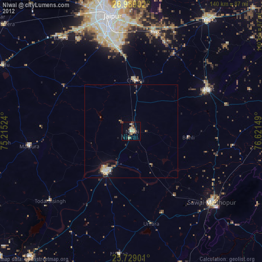
Niwai night lights from space
Night Light of Niwai (Rajasthan) from space (India) Src. Average luminocity for 10x10km area is 24.3902% and for 50x50km: 3.4526%.
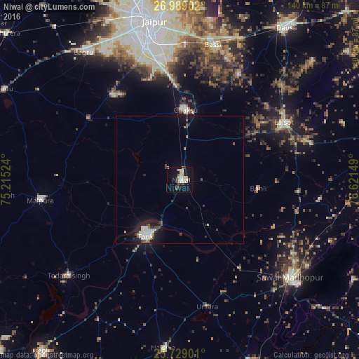
Analysis of Niwai night lights 2016
Square area 10x10 km:
 3.6%
3.6%90-99
4.17%80-89
5.68%70-79
1.33%60-69
1.89%50-59
2.84%40-49
2.46%30-39
2.84%20-29
1.14%10-19
23.11%0-9
50.95%Square area 50x50 km:
0.42%90-99
0.8%80-89
0.41%70-79
0.11%60-69
0.25%50-59
0.38%40-49
0.49%30-39
0.45%20-29
0.54%10-19
3.26%0-9
92.89%Clear (daylight) street map image can be seen on geolist.org.
Map coordinates:
26° 59' 20.5" North, 75° 12' 54.9" East
26° 21' 38.6" North, 75° 55' 6.1" East
25° 43' 44.4" North, 76° 37' 17.4" East
Some cities around Niwai sort by population:
• Jaipur
63.5 km =39.5 mi,  348°
348°
• Tonk
25.2 km =15.7 mi,  210°
210°
• Sawāi Mādhopur
56.7 km =35.2 mi,  131°
131°
• Chaksu
27.3 km =17 mi,  6°
6°
• Lālsot
46.5 km =28.9 mi,  61°
61°
• Mālpura
55.8 km =34.7 mi,  261°
261°
• Todaraisingh
57.4 km =35.7 mi,  229°
229°
• Basi
53.9 km =33.5 mi, 13°
1261614 (p: 35,114)
Sources (retrieved 2019-11-25):
» Earth at Night: Flat Maps 2012, 2016