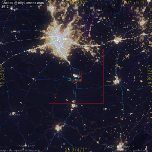
Chaksu night lights from space
Night Light of Chaksu (Rajasthan) from space (India) Src. Average luminocity for 10x10km area is 24.0322% and for 50x50km: 16.5619%.
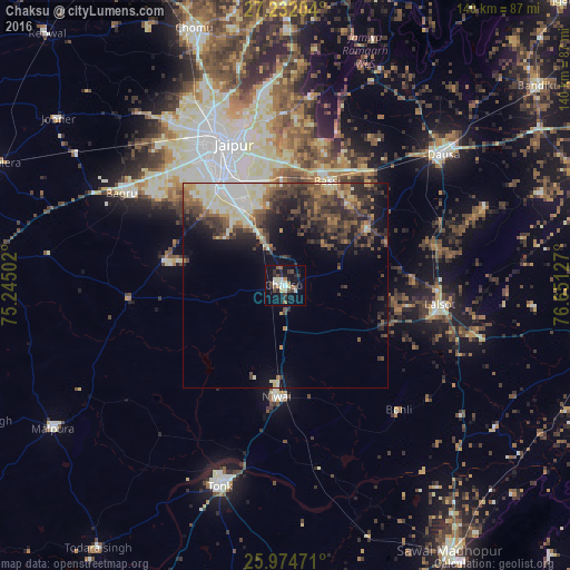
Analysis of Chaksu night lights 2016
Square area 10x10 km:
100  2.27%
2.27%
90-99 5.11%
80-89 2.46%
70-79 0.76%
60-69 2.84%
50-59 3.03%
40-49 3.98%
30-39 4.55%
20-29 6.44%
10-19 23.48%
0-9 45.08%
2.27%90-99
5.11%80-89
2.46%70-79
0.76%60-69
2.84%50-59
3.03%40-49
3.98%30-39
4.55%20-29
6.44%10-19
23.48%0-9
45.08%Square area 50x50 km:
100 1.93%
90-99 2.93%
80-89 2.09%
70-79 1.38%
60-69 1.94%
50-59 2.76%
40-49 4.01%
30-39 4.1%
20-29 5.02%
10-19 6.89%
0-9 66.94%
1.93%90-99
2.93%80-89
2.09%70-79
1.38%60-69
1.94%50-59
2.76%40-49
4.01%30-39
4.1%20-29
5.02%10-19
6.89%0-9
66.94%Clear (daylight) street map image can be seen on geolist.org.
Map coordinates:
27° 13' 55.3" North, 75° 14' 42.1" East
26° 36' 18.4" North, 75° 56' 53.3" East
25° 58' 29" North, 76° 39' 4.6" East
Some cities around Chaksu sort by population:
• Jaipur
38.4 km =23.9 mi,  335°
335°
• Tonk
51.3 km =31.9 mi,  198°
198°
• Dausa
49.9 km =31 mi,  50°
50°
• Niwai
27.3 km =17 mi,  186°
186°
• Lālsot
38.2 km =23.7 mi,  97°
97°
• Mālpura
68.2 km =42.4 mi,  238°
238°
• Basi
27.1 km =16.8 mi,  21°
21°
• Jobner
69 km =42.9 mi,  306°
306°
1274532 (p: 33,098)
Sources (retrieved 2019-11-25):
» Earth at Night: Flat Maps 2012, 2016