Negapatam night lights from space
Night Light of Negapatam (Tamil Nadu) from space (India) Src. Average luminocity for 10x10km area is 33.0909% and for 50x50km: 9.6194%.
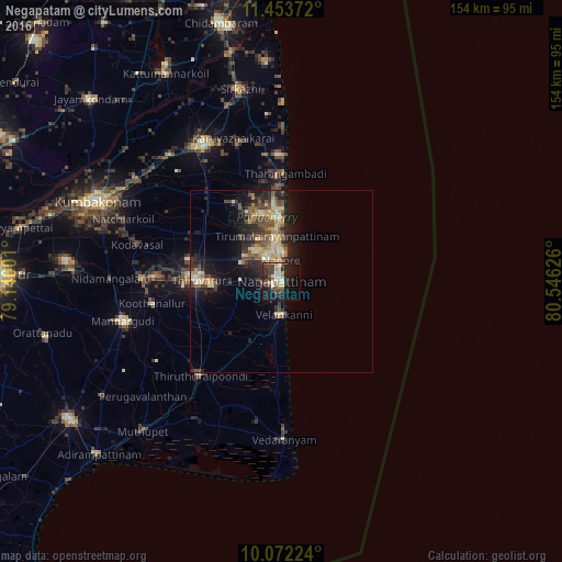
Analysis of Negapatam night lights 2016
Square area 10x10 km:
 0.21%
0.21%90-99
8.26%80-89
5.17%70-79
3.31%60-69
2.48%50-59
4.55%40-49
9.5%30-39
6.4%20-29
12.4%10-19
27.48%0-9
20.25%Square area 50x50 km:
0.13%90-99
1.65%80-89
1.51%70-79
1.53%60-69
0.71%50-59
1.87%40-49
2.25%30-39
1.61%20-29
3.61%10-19
6.82%0-9
78.32%Clear (daylight) street map image can be seen on geolist.org.
Map coordinates:
11° 27' 13.4" North, 79° 8' 24" East
10° 45' 49.6" North, 79° 50' 35.3" East
10° 4' 20.1" North, 80° 32' 46.5" East
Some cities around Negapatam sort by population:
• Kāraikāl
17 km =10.6 mi,  356°
356°
• Thiruvarur
22.6 km =14 mi,  272°
272°
• Koothanallur
36.1 km =22.4 mi,  262°
262°
• Tharangambadi
29.4 km =18.3 mi,  2°
2°
• Nannilam
28.5 km =17.7 mi,  296°
296°
• Velankanni
9 km =5.6 mi,  186°
186°
• Kilvelur
11.1 km =6.9 mi, 271°
• Koradāchcheri
38.4 km =23.9 mi, 271°
1262260 (p: 94,238)
Sources (retrieved 2019-11-25):
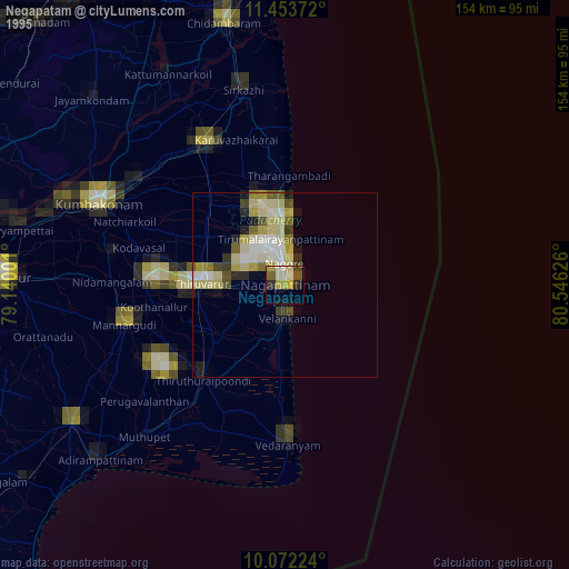
» NASA, Earths city lights 1995
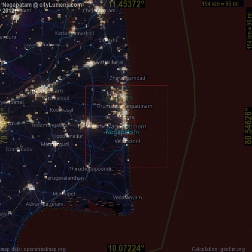
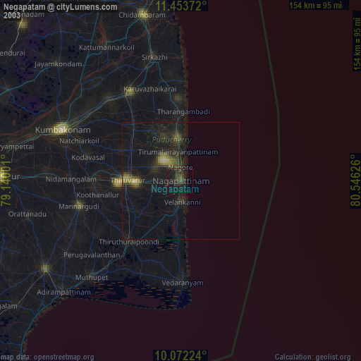
» NASA city lights 2003
» Earth at Night: Flat Maps 2012, 2016