Thiruvarur night lights from space
Night Light of Thiruvarur (Tamil Nadu) from space (India) Src. Average luminocity for 10x10km area is 40.3161% and for 50x50km: 13.0019%.
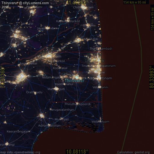

Analysis of Thiruvarur night lights 2016
Square area 10x10 km:
 0.41%
0.41%90-99
8.47%80-89
5.58%70-79
7.85%60-69
3.72%50-59
6.61%40-49
12.6%30-39
5.79%20-29
13.84%10-19
30.17%0-9
4.96%Square area 50x50 km:
0.18%90-99
1.88%80-89
1.79%70-79
2.01%60-69
1.04%50-59
2.34%40-49
3.46%30-39
3.15%20-29
5.07%10-19
8.16%0-9
70.93%Clear (daylight) street map image can be seen on geolist.org.
Map coordinates:
11° 27' 45.4" North, 78° 56' 1.2" East
10° 46' 21.7" North, 79° 38' 12.5" East
10° 4' 52.2" North, 80° 20' 23.7" East
Some cities around Thiruvarur sort by population:
• Negapatam
22.6 km =14 mi,  92°
92°
• Mannargudi
23.5 km =14.6 mi,  239°
239°
• Koothanallur
14.5 km =9 mi,  246°
246°
• Nannilam
12.2 km =7.6 mi,  346°
346°
• Velankanni
23.7 km =14.7 mi,  114°
114°
• Needamangalam
23.8 km =14.8 mi,  270°
270°
• Kilvelur
11.5 km =7.1 mi, 93°
• Koradāchcheri
15.9 km =9.9 mi, 268°
1254589 (p: 58,777)
Sources (retrieved 2019-11-25):
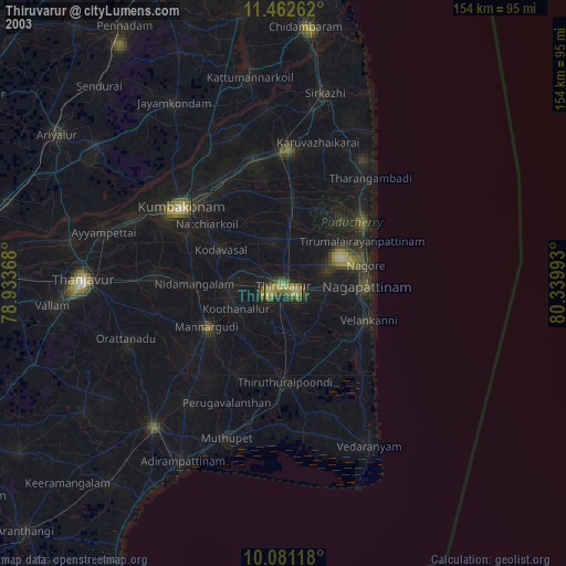
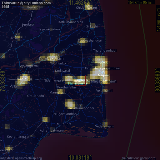
» NASA, Earths city lights 1995
» NASA city lights 2003
» Earth at Night: Flat Maps 2012, 2016