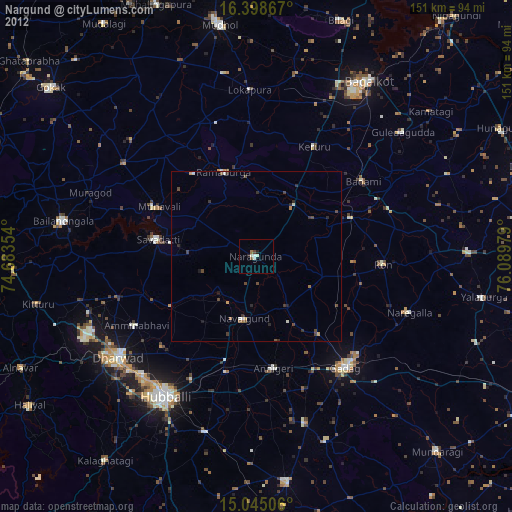
Nargund night lights from space
Night Light of Nargund (Karnataka) from space (India) Src. Average luminocity for 10x10km area is 11.013% and for 50x50km: 2.4743%.
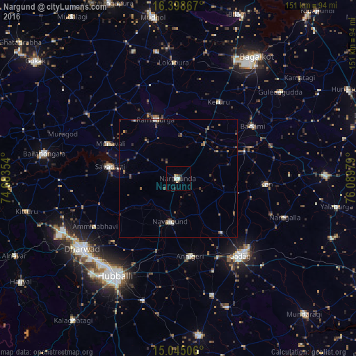
Analysis of Nargund night lights 2016
Square area 10x10 km:
 1.95%
1.95%90-99
2.38%80-89
1.73%70-79
0%60-69
1.73%50-59
0%40-49
0%30-39
2.81%20-29
4.11%10-19
0%0-9
85.28%Square area 50x50 km:
0.18%90-99
0.28%80-89
0.11%70-79
0.14%60-69
0.53%50-59
0.31%40-49
0.67%30-39
0.74%20-29
0.79%10-19
0.38%0-9
95.87%Clear (daylight) street map image can be seen on geolist.org.
Map coordinates:
16° 23' 55.2" North, 74° 41' 0.7" East
15° 43' 22.8" North, 75° 23' 12" East
15° 2' 42.2" North, 76° 5' 23.2" East
Some cities around Nargund sort by population:
• Gadag-Betageri
42 km =26.1 mi,  144°
144°
• Gadag
41.7 km =25.9 mi, 141°
• Saundatti
29.2 km =18.1 mi,  279°
279°
• Bādāmi
37.7 km =23.4 mi,  55°
55°
• Annigeri
33.5 km =20.8 mi,  171°
171°
• Navalgund
18.6 km =11.6 mi,  191°
191°
• Ron
37.3 km =23.2 mi,  94°
94°
• Kerūr
36.6 km =22.7 mi,  27°
27°
1261800 (p: 33,403)
Sources (retrieved 2019-11-25):
» Earth at Night: Flat Maps 2012, 2016