Naraina night lights from space
Night Light of Naraina (Rajasthan) from space (India) Src. Average luminocity for 10x10km area is 1.3948% and for 50x50km: 2.9635%.
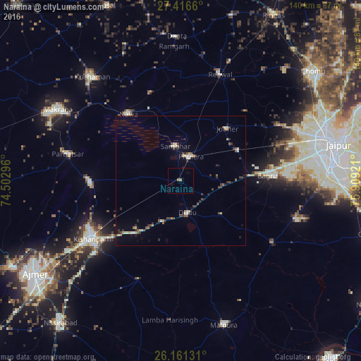
Analysis of Naraina night lights 2016
Square area 10x10 km:
 0%
0%90-99
0%80-89
0%70-79
0%60-69
0.79%50-59
0.79%40-49
0%30-39
0%20-29
0.4%10-19
0%0-9
98.02%Square area 50x50 km:
0.11%90-99
0.38%80-89
0.5%70-79
0.18%60-69
0.29%50-59
0.57%40-49
0.44%30-39
0.8%20-29
0.54%10-19
0.65%0-9
95.54%Clear (daylight) street map image can be seen on geolist.org.
Map coordinates:
27° 24' 59.8" North, 74° 30' 10.7" East
26° 47' 26.5" North, 75° 12' 21.9" East
26° 9' 40.7" North, 75° 54' 33.2" East
Some cities around Naraina sort by population:
• Kishangarh
41.5 km =25.8 mi,  237°
237°
• Kuchāman
52.7 km =32.7 mi,  318°
318°
• Rāmgarh
51.2 km =31.8 mi,  356°
356°
• Sāmbhar
13.1 km =8.1 mi,  353°
353°
• Phulera
9.9 km =6.2 mi,  20°
20°
• Nāwa
32.5 km =20.2 mi, 321°
• Parvatsar
44.9 km =27.9 mi,  283°
283°
• Jobner
27.1 km =16.8 mi,  41°
41°
1261872 (p: 17,048)
Sources (retrieved 2019-11-25):
» Earth at Night: Flat Maps 2012, 2016