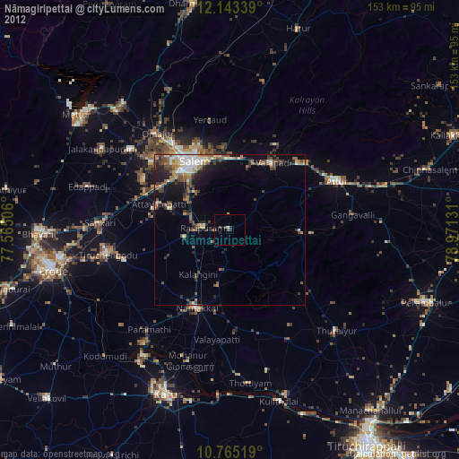
Nāmagiripettai night lights from space
Night Light of Nāmagiripettai (Tamil Nadu) from space (India) Src. Average luminocity for 10x10km area is 32.8528% and for 50x50km: 22.8141%.
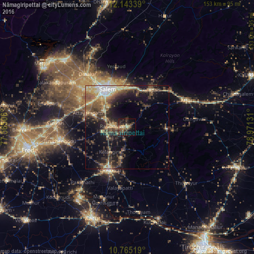
Analysis of Nāmagiripettai night lights 2016
Square area 10x10 km:
 0%
0%90-99
2.38%80-89
6.93%70-79
3.25%60-69
4.11%50-59
6.49%40-49
9.31%30-39
11.69%20-29
15.37%10-19
21.21%0-9
19.26%Square area 50x50 km:
1.38%90-99
2.84%80-89
3.76%70-79
3.03%60-69
2.8%50-59
4.99%40-49
5.11%30-39
5.6%20-29
7.25%10-19
13.08%0-9
50.17%Clear (daylight) street map image can be seen on geolist.org.
Map coordinates:
12° 8' 36.2" North, 77° 33' 54.2" East
11° 27' 18.5" North, 78° 16' 5.4" East
10° 45' 54.7" North, 78° 58' 16.7" East
Some cities around Nāmagiripettai sort by population:
• Salem
25.3 km =15.7 mi,  330°
330°
• Nāmakkal
28.3 km =17.6 mi,  203°
203°
• Rasipuram
8.9 km =5.5 mi,  273°
273°
• Mallasamudram
26.2 km =16.3 mi,  279°
279°
• Āttayyāmpatti
24.9 km =15.5 mi,  290°
290°
• Ilampillai
33.1 km =20.6 mi,  300°
300°
• Māllūr
17.1 km =10.6 mi,  305°
305°
• Belūr
32.3 km =20.1 mi,  29°
29°
1262040 (p: 22,098)
Sources (retrieved 2019-11-25):
» Earth at Night: Flat Maps 2012, 2016