Nāmakkal night lights from space
Night Light of Nāmakkal (Tamil Nadu) from space (India) Src. Average luminocity for 10x10km area is 55.1797% and for 50x50km: 14.4474%.
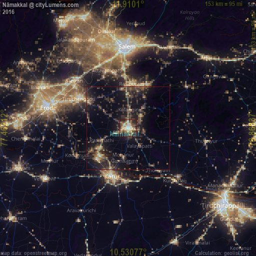
Analysis of Nāmakkal night lights 2016
Square area 10x10 km:
 2.38%
2.38%90-99
11.47%80-89
11.47%70-79
7.79%60-69
9.09%50-59
13.64%40-49
8.87%30-39
11.9%20-29
17.1%10-19
6.28%0-9
0%Square area 50x50 km:
0.15%90-99
0.86%80-89
1.15%70-79
1.44%60-69
1.67%50-59
2.72%40-49
4.27%30-39
5.11%20-29
7.62%10-19
13.7%0-9
61.31%Clear (daylight) street map image can be seen on geolist.org.
Map coordinates:
11° 54' 36.4" North, 77° 27' 43.6" East
11° 13' 16.5" North, 78° 9' 54.9" East
10° 31' 50.8" North, 78° 52' 6.1" East
Some cities around Nāmakkal sort by population:
• Karur
30.7 km =19.1 mi,  197°
197°
• Rasipuram
26.7 km =16.6 mi,  4°
4°
• Nāmagiripettai
28.3 km =17.6 mi,  23°
23°
• Velur
21.9 km =13.6 mi,  234°
234°
• Mohanūr
18.2 km =11.3 mi,  188°
188°
• Kāttupputtūr
26 km =16.2 mi,  166°
166°
• Erumaippatti
15.9 km =9.9 mi,  121°
121°
• Puduppatti
9.2 km =5.7 mi,  146°
146°
1262039 (p: 55,997)
Sources (retrieved 2019-11-25):
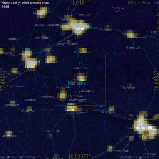
» NASA, Earths city lights 1995
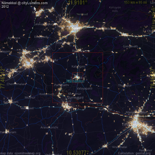
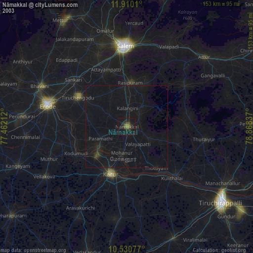
» NASA city lights 2003
» Earth at Night: Flat Maps 2012, 2016