Māllūr night lights from space
Night Light of Māllūr (Tamil Nadu) from space (India) Src. Average luminocity for 10x10km area is 51.3009% and for 50x50km: 36.1232%.
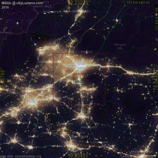
Analysis of Māllūr night lights 2016
Square area 10x10 km:
 0%
0%90-99
4.98%80-89
8.01%70-79
9.74%60-69
9.09%50-59
19.26%40-49
12.55%30-39
18.83%20-29
14.72%10-19
2.81%0-9
0%Square area 50x50 km:
1.63%90-99
3.66%80-89
6.59%70-79
6.36%60-69
6.52%50-59
10.38%40-49
8.2%30-39
6.67%20-29
8.02%10-19
14.94%0-9
27.03%Clear (daylight) street map image can be seen on geolist.org.
Map coordinates:
12° 13' 56.2" North, 77° 26' 15.6" East
11° 32' 39.3" North, 78° 8' 26.8" East
10° 51' 16.2" North, 78° 50' 38.1" East
Some cities around Māllūr sort by population:
• Salem
12.3 km =7.6 mi,  7°
7°
• Rasipuram
10.6 km =6.6 mi,  152°
152°
• Tāramangalam
24.9 km =15.5 mi,  311°
311°
• Nāmagiripettai
17.1 km =10.6 mi,  125°
125°
• Mallasamudram
13.2 km =8.2 mi,  244°
244°
• Āttayyāmpatti
9.6 km =6 mi,  262°
262°
• Omalur
24.2 km =15 mi,  334°
334°
• Ilampillai
16.2 km =10.1 mi,  295°
295°
1264041 (p: 10,524)
Sources (retrieved 2019-11-25):
» Earth at Night: Flat Maps 2012, 2016