Munirābād night lights from space
Night Light of Munirābād (Karnataka) from space (India) Src. Average luminocity for 10x10km area is 58.0103% and for 50x50km: 20.3583%.
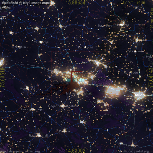
Analysis of Munirābād night lights 2016
Square area 10x10 km:
 7.64%
7.64%90-99
11.36%80-89
6.61%70-79
10.54%60-69
10.95%50-59
10.33%40-49
11.16%30-39
9.5%20-29
17.98%10-19
3.93%0-9
0%Square area 50x50 km:
1.63%90-99
3.17%80-89
2.24%70-79
1.49%60-69
3.02%50-59
3.93%40-49
4.03%30-39
4.01%20-29
7.57%10-19
15.32%0-9
53.6%Clear (daylight) street map image can be seen on geolist.org.
Map coordinates:
15° 59' 10.8" North, 75° 38' 6.6" East
15° 18' 33.4" North, 76° 20' 17.9" East
14° 37' 48.1" North, 77° 2' 29.1" East
Some cities around Munirābād sort by population:
• Hospet
6.8 km =4.2 mi,  130°
130°
• Gangāwati
24.6 km =15.3 mi,  56°
56°
• Koppal
20.1 km =12.5 mi,  281°
281°
• Kampli
30.1 km =18.7 mi,  68°
68°
• Sandūr
33.4 km =20.8 mi,  137°
137°
• Kūdligi
45.2 km =28.1 mi,  173°
173°
• Yelbarga
48.8 km =30.3 mi,  314°
314°
• Hampi
13.4 km =8.3 mi,  77°
77°
1262469 (p: 8,246)
Sources (retrieved 2019-11-25):
» Earth at Night: Flat Maps 2012, 2016