Gangāwati night lights from space
Night Light of Gangāwati (Karnataka) from space (India) Src. Average luminocity for 10x10km area is 45.3918% and for 50x50km: 17.68%.
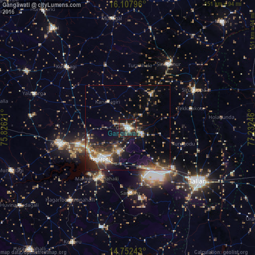
Analysis of Gangāwati night lights 2016
Square area 10x10 km:
 5.63%
5.63%90-99
11.04%80-89
6.49%70-79
1.52%60-69
3.68%50-59
6.28%40-49
9.09%30-39
11.9%20-29
19.48%10-19
24.89%0-9
0%Square area 50x50 km:
1.34%90-99
2.56%80-89
1.43%70-79
1.62%60-69
2.91%50-59
3.7%40-49
3.28%30-39
3.63%20-29
6.46%10-19
12.11%0-9
60.96%Clear (daylight) street map image can be seen on geolist.org.
Map coordinates:
16° 6' 28.7" North, 75° 49' 34.4" East
15° 25' 52.7" North, 76° 31' 45.6" East
14° 45' 8.7" North, 77° 13' 56.9" East
Some cities around Gangāwati sort by population:
• Hospet
23.6 km =14.7 mi,  220°
220°
• Koppal
41.3 km =25.7 mi,  256°
256°
• Siruguppa
44.7 km =27.8 mi,  60°
60°
• Kampli
8.1 km =5 mi,  110°
110°
• Sandūr
38.4 km =23.9 mi,  177°
177°
• Tekkalakote
39 km =24.2 mi,  72°
72°
• Hampi
13 km =8.1 mi,  214°
214°
• Munirābād
24.6 km =15.3 mi,  236°
236°
1271662 (p: 106,250)
Sources (retrieved 2019-11-25):
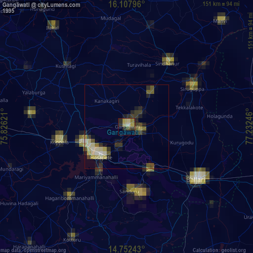
» NASA, Earths city lights 1995
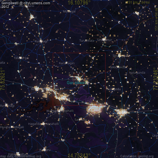
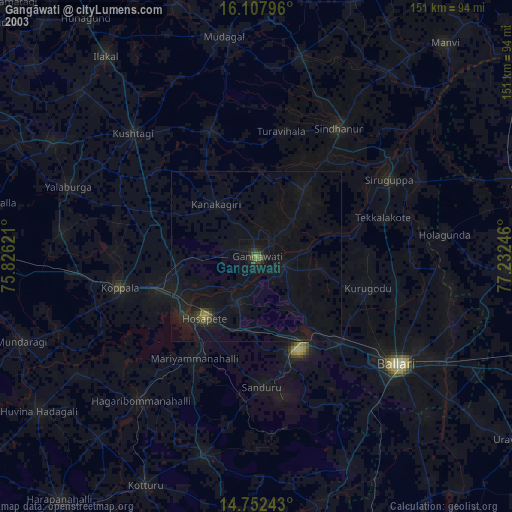
» NASA city lights 2003
» Earth at Night: Flat Maps 2012, 2016