Hospet night lights from space
Night Light of Hospet (Karnataka) from space (India) Src. Average luminocity for 10x10km area is 69.4298% and for 50x50km: 22.4339%.
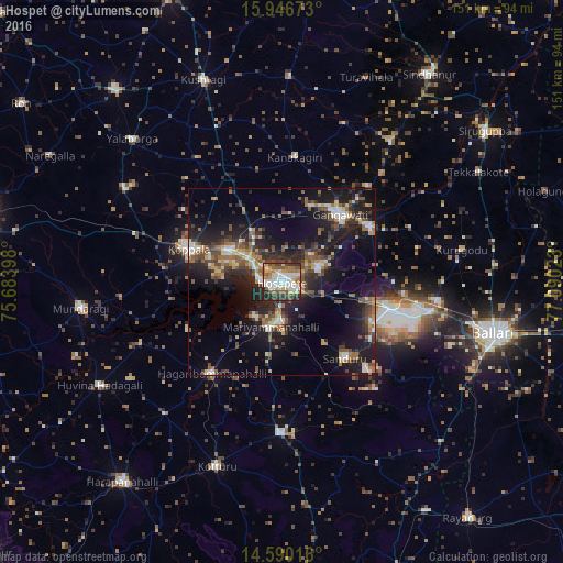
Analysis of Hospet night lights 2016
Square area 10x10 km:
 14.46%
90-99
21.07%80-89
8.06%70-79
5.79%60-69
12.81%50-59
11.16%40-49
9.71%30-39
7.23%20-29
9.71%10-19
0%0-9
0%Square area 50x50 km:
1.79%90-99
3.44%80-89
2.42%70-79
1.77%60-69
3.69%50-59
4.08%40-49
4.26%30-39
4.43%20-29
8.23%10-19
17.74%0-9
48.16%Clear (daylight) street map image can be seen on geolist.org.
Map coordinates:
15° 56' 48.2" North, 75° 41' 2.3" East
15° 16' 10.3" North, 76° 23' 13.6" East
14° 35' 24.6" North, 77° 5' 24.8" East
Some cities around Hospet sort by population:
• Gangāwati
23.6 km =14.7 mi,  40°
40°
• Koppal
26.3 km =16.3 mi,  288°
288°
• Kampli
27.4 km =17 mi,  56°
56°
• Sandūr
26.6 km =16.5 mi,  139°
139°
• Kottūru
52.6 km =32.7 mi,  199°
199°
• Kūdligi
40.5 km =25.2 mi,  180°
180°
• Hampi
10.7 km =6.6 mi,  47°
47°
• Munirābād
6.8 km =4.2 mi,  310°
310°
1269935 (p: 197,846)
Sources (retrieved 2019-11-25):
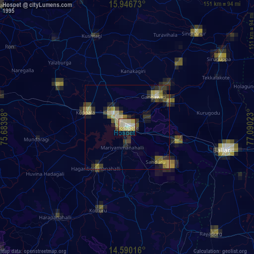
» NASA, Earths city lights 1995
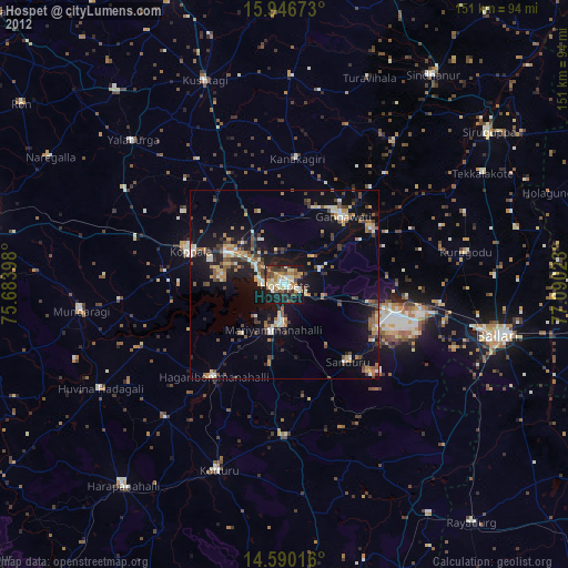
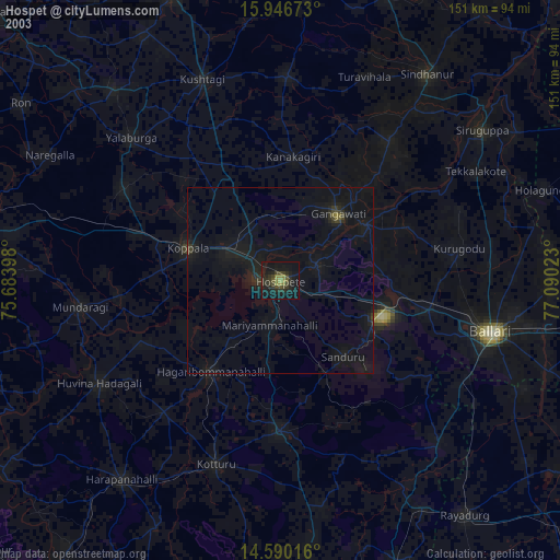
» NASA city lights 2003
» Earth at Night: Flat Maps 2012, 2016