Mūndwa night lights from space
Night Light of Mūndwa (Rajasthan) from space (India) Src. Average luminocity for 10x10km area is 8.3968% and for 50x50km: 4.1181%.
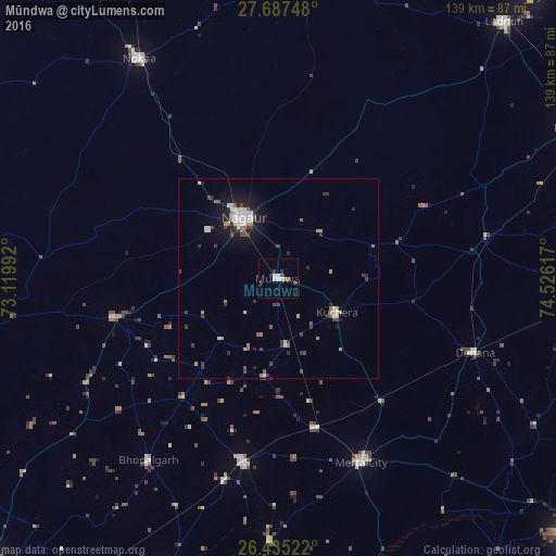
Analysis of Mūndwa night lights 2016
Square area 10x10 km:
100  0.6%
0.6%
90-99 2.78%
80-89 0.6%
70-79 0%
60-69 0.79%
50-59 0.79%
40-49 1.79%
30-39 2.78%
20-29 0.6%
10-19 0.4%
0-9 88.89%
0.6%90-99
2.78%80-89
0.6%70-79
0%60-69
0.79%50-59
0.79%40-49
1.79%30-39
2.78%20-29
0.6%10-19
0.4%0-9
88.89%Square area 50x50 km:
100 0.29%
90-99 0.98%
80-89 0.28%
70-79 0.5%
60-69 0.35%
50-59 0.41%
40-49 0.67%
30-39 1.03%
20-29 0.63%
10-19 2.62%
0-9 92.25%
0.29%90-99
0.98%80-89
0.28%70-79
0.5%60-69
0.35%50-59
0.41%40-49
0.67%30-39
1.03%20-29
0.63%10-19
2.62%0-9
92.25%Clear (daylight) street map image can be seen on geolist.org.
Map coordinates:
27° 41' 14.9" North, 73° 7' 11.7" East
27° 3' 47.2" North, 73° 49' 22.9" East
26° 26' 6.8" North, 74° 31' 34.2" East
Some cities around Mūndwa sort by population:
• Nāgaur
17.8 km =11.1 mi,  330°
330°
• Lādnūn
86.9 km =54 mi,  40°
40°
• Nokha
65.4 km =40.6 mi, 327°
• Dīdwāna
83.3 km =51.8 mi,  63°
63°
• Merta
50.6 km =31.4 mi,  155°
155°
• Pīpār
80.4 km =50 mi,  200°
200°
• Basni
21.4 km =13.3 mi,  304°
304°
• Kuchera
16.9 km =10.5 mi,  119°
119°
1262491 (p: 17,465)
Sources (retrieved 2019-11-25):
» Earth at Night: Flat Maps 2012, 2016