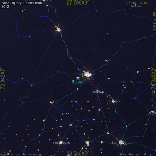
Basni night lights from space
Night Light of Basni (Rajasthan) from space (India) Src. Average luminocity for 10x10km area is 8.3731% and for 50x50km: 3.2429%.
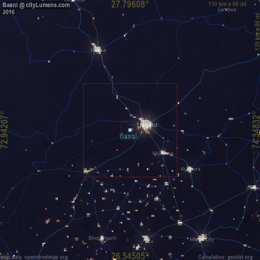
Analysis of Basni night lights 2016
Square area 10x10 km:
100  0.19%
0.19%
90-99 2.84%
80-89 0%
70-79 0.76%
60-69 0%
50-59 0%
40-49 0.76%
30-39 1.52%
20-29 0.95%
10-19 14.96%
0-9 78.03%
0.19%90-99
2.84%80-89
0%70-79
0.76%60-69
0%50-59
0%40-49
0.76%30-39
1.52%20-29
0.95%10-19
14.96%0-9
78.03%Square area 50x50 km:
100 0.28%
90-99 0.84%
80-89 0.23%
70-79 0.26%
60-69 0.25%
50-59 0.37%
40-49 0.63%
30-39 0.58%
20-29 0.43%
10-19 2.64%
0-9 93.5%
0.28%90-99
0.84%80-89
0.23%70-79
0.26%60-69
0.25%50-59
0.37%40-49
0.63%30-39
0.58%20-29
0.43%10-19
2.64%0-9
93.5%Clear (daylight) street map image can be seen on geolist.org.
Map coordinates:
27° 47' 45.9" North, 72° 56' 31.5" East
27° 10' 20.4" North, 73° 38' 42.7" East
26° 32' 42.2" North, 74° 20' 54" East
Some cities around Basni sort by population:
• Nāgaur
9.4 km =5.8 mi,  69°
69°
• Nokha
46.6 km =29 mi,  338°
338°
• Merta
69.8 km =43.4 mi,  146°
146°
• Pīpār
88.2 km =54.8 mi,  186°
186°
• Kuchera
38.3 km =23.8 mi,  122°
122°
• Napāsar
88.1 km =54.7 mi,  354°
354°
• Mūndwa
21.4 km =13.3 mi, 124°
• Deshnoke
75.7 km =47 mi, 336°
1276754 (p: 23,414)
Sources (retrieved 2019-11-25):
» Earth at Night: Flat Maps 2012, 2016