Mudgal night lights from space
Night Light of Mudgal (Karnataka) from space (India) Src. Average luminocity for 10x10km area is 11.4463% and for 50x50km: 3.9351%.
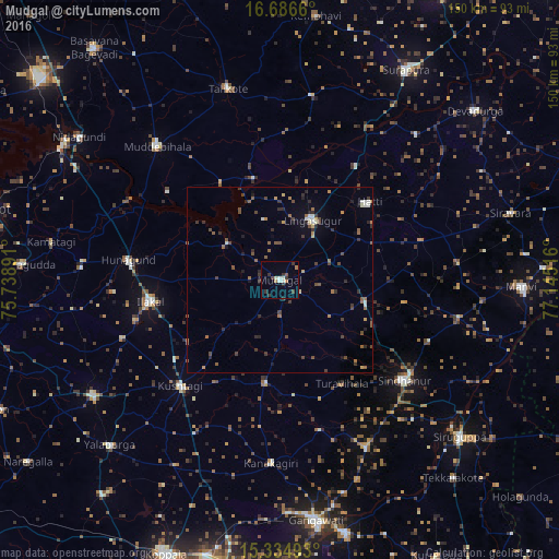
Analysis of Mudgal night lights 2016
Square area 10x10 km:
 1.03%
1.03%90-99
2.89%80-89
0.21%70-79
0%60-69
2.48%50-59
0.83%40-49
0.83%30-39
6.2%20-29
0.83%10-19
0%0-9
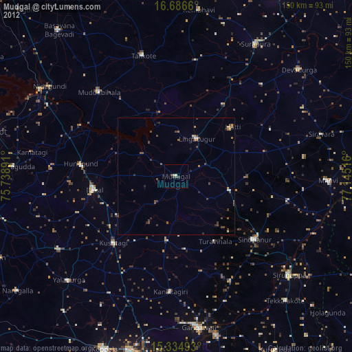
84.71%Square area 50x50 km:
0.24%90-99
0.5%80-89
0.19%70-79
0.25%60-69
0.64%50-59
0.77%40-49
0.92%30-39
1.16%20-29
0.95%10-19
0.62%0-9
93.77%Clear (daylight) street map image can be seen on geolist.org.
Map coordinates:
16° 41' 11.8" North, 75° 44' 20.1" East
16° 0' 42.9" North, 76° 26' 31.3" East
15° 20' 5.7" North, 77° 8' 42.6" East
Some cities around Mudgal sort by population:
• Sindhnūr
43 km =26.7 mi,  128°
128°
• Ilkal
35.6 km =22.1 mi,  260°
260°
• Muddebihāl
49.1 km =30.5 mi,  317°
317°
• Lingsugūr
18.4 km =11.4 mi,  27°
27°
• Gajendragarh
59.1 km =36.7 mi,  238°
238°
• Tālīkota
53.2 km =33.1 mi,  344°
344°
• Kushtagi
39.1 km =24.3 mi,  223°
223°
• Hungund
41.4 km =25.7 mi,  277°
277°
1262664 (p: 21,006)
Sources (retrieved 2019-11-25):
» Earth at Night: Flat Maps 2012, 2016