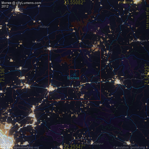
Morwa night lights from space
Night Light of Morwa (Gujarat) from space (India) Src. Average luminocity for 10x10km area is 0.0813% and for 50x50km: 5.9367%.
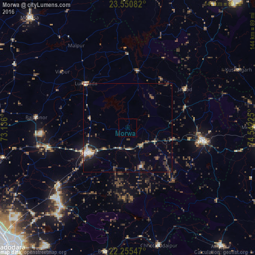
Analysis of Morwa night lights 2016
Square area 10x10 km:
 0%
0%90-99
0%80-89
0%70-79
0%60-69
0%50-59
0%40-49
0%30-39
0%20-29
0%10-19
0%0-9
100%Square area 50x50 km:
0.17%90-99
0.91%80-89
0.37%70-79
0.44%60-69
0.62%50-59
1.24%40-49
1.35%30-39
1.51%20-29
2.12%10-19
3.18%0-9
88.1%Clear (daylight) street map image can be seen on geolist.org.
Map coordinates:
23° 33' 3" North, 73° 8' 9.6" East
22° 54' 16.9" North, 73° 50' 20.8" East
22° 15' 19.7" North, 74° 32' 32.1" East
Some cities around Morwa sort by population:
• Godhra
27.1 km =16.8 mi,  237°
237°
• Vejalpur
37 km =23 mi,  229°
229°
• Dohad
43.8 km =27.2 mi,  100°
100°
• Hālol
58.4 km =36.3 mi,  220°
220°
• Lūnāvāda
34.2 km =21.3 mi,  316°
316°
• Kālol
50.8 km =31.6 mi, 229°
• Devgadh Bāriya
23.3 km =14.5 mi,  162°
162°
• Virpur
48.5 km =30.1 mi,  310°
310°
1262734 (p: 20,168)
Sources (retrieved 2019-11-25):
» Earth at Night: Flat Maps 2012, 2016