Godhra night lights from space
Night Light of Godhra (Gujarat) from space (India) Src. Average luminocity for 10x10km area is 44.7004% and for 50x50km: 9.1109%.
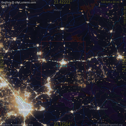
Analysis of Godhra night lights 2016
Square area 10x10 km:
 3.57%
3.57%90-99
13.89%80-89
5.16%70-79
5.36%60-69
4.17%50-59
6.15%40-49
6.94%30-39
6.15%20-29
12.5%10-19
34.92%0-9
1.19%Square area 50x50 km:
0.2%90-99
1.26%80-89
0.67%70-79
0.7%60-69
0.87%50-59
1.88%40-49
2.14%30-39
2.5%20-29
3%10-19
8.21%0-9
78.58%Clear (daylight) street map image can be seen on geolist.org.
Map coordinates:
23° 25' 20" North, 72° 54' 42.3" East
22° 46' 31.7" North, 73° 36' 53.6" East
22° 7' 32.3" North, 74° 19' 4.8" East
Some cities around Godhra sort by population:
• Vejalpur
10.9 km =6.8 mi,  209°
209°
• Hālol
33.6 km =20.9 mi, 205°
• Lūnāvāda
39.2 km =24.4 mi,  359°
359°
• Kālol
24.3 km =15.1 mi,  219°
219°
• Morwa
27.1 km =16.8 mi,  57°
57°
• Devgadh Bāriya
31.1 km =19.3 mi,  104°
104°
• Thāsra
41.4 km =25.7 mi,  273°
273°
• Shivrājpur
39.2 km =24.4 mi,  180°
180°
1271107 (p: 131,913)
Sources (retrieved 2019-11-25):
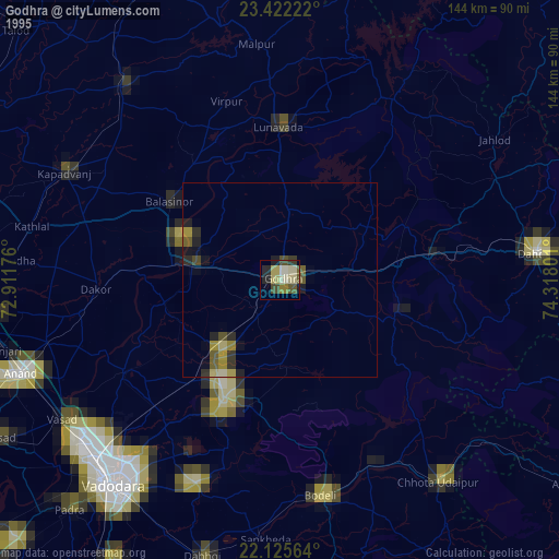
» NASA, Earths city lights 1995
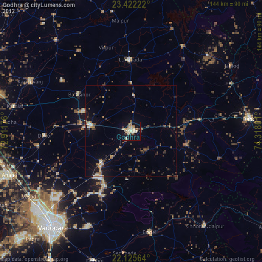
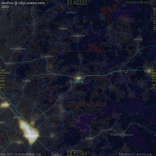
» NASA city lights 2003
» Earth at Night: Flat Maps 2012, 2016