Kālol night lights from space
Night Light of Kālol (Gujarat) from space (India) Src. Average luminocity for 10x10km area is 31.8731% and for 50x50km: 14.6449%.
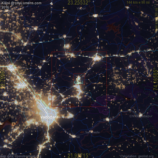
Analysis of Kālol night lights 2016
Square area 10x10 km:
 0.76%
0.76%90-99
7.2%80-89
5.68%70-79
1.7%60-69
2.65%50-59
4.55%40-49
5.87%30-39
7.39%20-29
12.88%10-19
33.52%0-9
17.8%Square area 50x50 km:
0.53%90-99
2.45%80-89
1.56%70-79
1.34%60-69
1.56%50-59
2.49%40-49
3.04%30-39
3.68%20-29
5.48%10-19
13.37%0-9
64.5%Clear (daylight) street map image can be seen on geolist.org.
Map coordinates:
23° 15' 19.2" North, 72° 45' 34.6" East
22° 36' 28" North, 73° 27' 45.8" East
21° 57' 25.7" North, 74° 9' 57.1" East
Some cities around Kālol sort by population:
• Godhra
24.3 km =15.1 mi,  39°
39°
• Vejalpur
13.8 km =8.6 mi,  48°
48°
• Hālol
11.7 km =7.3 mi,  175°
175°
• Umreth
37 km =23 mi,  285°
285°
• Dākor
35.9 km =22.3 mi,  296°
296°
• Thāsra
33.3 km =20.7 mi,  309°
309°
• Vāghodia
34.3 km =21.3 mi,  190°
190°
• Shivrājpur
25.4 km =15.8 mi,  143°
143°
1268339 (p: 25,929)
Sources (retrieved 2019-11-25):
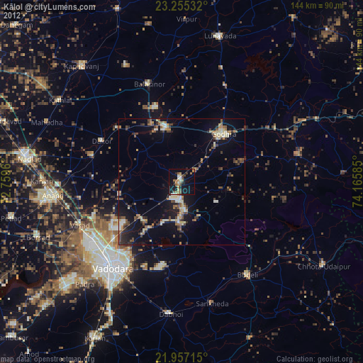
» Earth at Night: Flat Maps 2012, 2016