Masinigudi night lights from space
Night Light of Masinigudi (Tamil Nadu) from space (India) Src. Average luminocity for 10x10km area is 1.8831% and for 50x50km: 3.3781%.
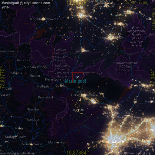
Analysis of Masinigudi night lights 2016
Square area 10x10 km:
 0%
0%90-99
0%80-89
0%70-79
0.65%60-69
1.08%50-59
0.87%40-49
0%30-39
0%20-29
0%10-19
0%0-9
97.4%Square area 50x50 km:
0.21%90-99
0.41%80-89
0.34%70-79
0.44%60-69
0.52%50-59
0.64%40-49
0.5%30-39
0.6%20-29
0.68%10-19
3.47%0-9
92.19%Clear (daylight) street map image can be seen on geolist.org.
Map coordinates:
12° 15' 22.6" North, 75° 56' 15.9" East
11° 34' 5.9" North, 76° 38' 27.1" East
10° 52' 43.1" North, 77° 20' 38.4" East
Some cities around Masinigudi sort by population:
• Ooty
18.2 km =11.3 mi,  161°
161°
• Mettupalayam
43.8 km =27.2 mi,  132°
132°
• Kotagiri
29 km =18 mi,  124°
124°
• Gundlupēt
27.4 km =17 mi,  11°
11°
• Wellington
27.4 km =17 mi,  145°
145°
• Sirumugai
48.3 km =30 mi, 124°
• Naduvattam
14.4 km =8.9 mi,  227°
227°
• Aruvankad
26.1 km =16.2 mi, 150°
1263418 (p: 9,642)
Sources (retrieved 2019-11-25):
» Earth at Night: Flat Maps 2012, 2016