Mettupalayam night lights from space
Night Light of Mettupalayam (Tamil Nadu) from space (India) Src. Average luminocity for 10x10km area is 39.5152% and for 50x50km: 17.0952%.
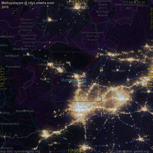
Analysis of Mettupalayam night lights 2016
Square area 10x10 km:
 0%
0%90-99
2.16%80-89
5.84%70-79
8.44%60-69
7.58%50-59
13.42%40-49
8.44%30-39
11.26%20-29
11.04%10-19
27.06%0-9
4.76%Square area 50x50 km:
0.25%90-99
1.16%80-89
2.37%70-79
3.29%60-69
3.02%50-59
4.15%40-49
5.03%30-39
4.49%20-29
4.68%10-19
9.52%0-9
62.05%Clear (daylight) street map image can be seen on geolist.org.
Map coordinates:
11° 59' 18.1" North, 76° 13' 54.2" East
11° 17' 59" North, 76° 56' 5.5" East
10° 36' 33.8" North, 77° 38' 16.7" East
Some cities around Mettupalayam sort by population:
• Kāramadai
7.1 km =4.4 mi,  157°
157°
• Kotagiri
15.7 km =9.8 mi,  328°
328°
• Periyanayakkanpalaiyam
16.5 km =10.3 mi,  173°
173°
• Wellington
18 km =11.2 mi,  294°
294°
• Sirumugai
8 km =5 mi,  72°
72°
• Annur
19.9 km =12.4 mi,  110°
110°
• Punjai Puliyampatti
25.9 km =16.1 mi,  77°
77°
• Aruvankad
20.5 km =12.7 mi, 290°
1263103 (p: 66,944)
Sources (retrieved 2019-11-25):
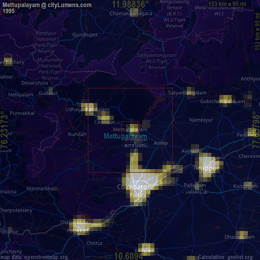
» NASA, Earths city lights 1995
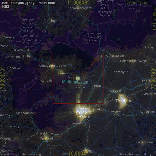
» NASA city lights 2003
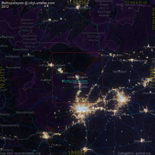
» Earth at Night: Flat Maps 2012, 2016