Marayur night lights from space
Night Light of Marayur (Kerala) from space (India) Src. Average luminocity for 10x10km area is 0.7417% and for 50x50km: 0.9365%.
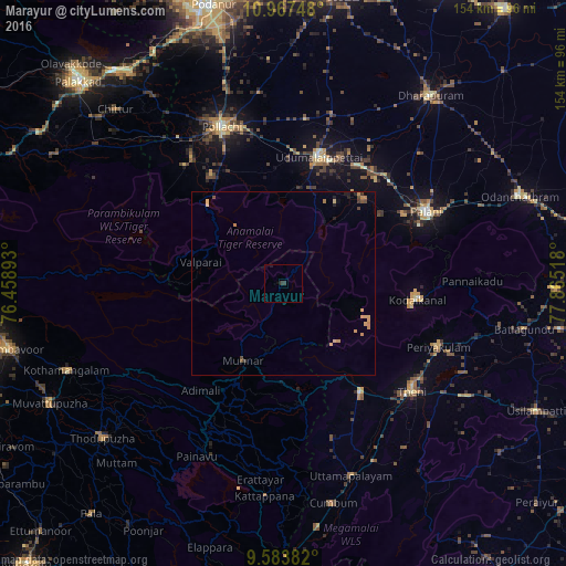
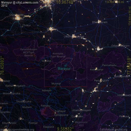
Analysis of Marayur night lights 2016
Square area 10x10 km:
 0%
0%90-99
0%80-89
0%70-79
0%60-69
0%50-59
0%40-49
0%30-39
1.65%20-29
0%10-19
0.83%0-9
97.52%Square area 50x50 km:
0%90-99
0%80-89
0.25%70-79
0.39%60-69
0.08%50-59
0.03%40-49
0.2%30-39
0.17%20-29
0.14%10-19
0.14%0-9
98.59%Clear (daylight) street map image can be seen on geolist.org.
Map coordinates:
10° 58' 2.9" North, 76° 27' 32.1" East
10° 16' 35.1" North, 77° 9' 43.4" East
9° 35' 1.8" North, 77° 51' 54.6" East
Some cities around Marayur sort by population:
• Valparai
23.7 km =14.7 mi,  283°
283°
• Bodināyakkanūr
35.9 km =22.3 mi,  145°
145°
• Munnar
23.6 km =14.7 mi,  207°
207°
• Udumalaippettai
35.9 km =22.3 mi,  15°
15°
• Kodaikānāl
36 km =22.4 mi,  96°
96°
• Vettaikkaranpudur
41.8 km =26 mi,  319°
319°
• Kumaralingam
31.3 km =19.4 mi,  40°
40°
• Dhali
26.2 km =16.3 mi,  6°
6°
1263566 (p: 25,000)
Sources (retrieved 2019-11-25):
» Earth at Night: Flat Maps 2012, 2016