Pālghāt night lights from space
Night Light of Pālghāt (Kerala) from space (India) Src. Average luminocity for 10x10km area is 49.812% and for 50x50km: 6.8684%.
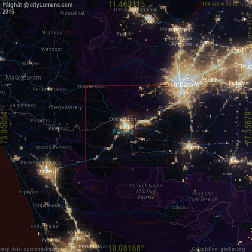
Analysis of Pālghāt night lights 2016
Square area 10x10 km:
 0.62%
0.62%90-99
9.3%80-89
10.12%70-79
15.29%60-69
3.93%50-59
9.3%40-49
6.61%30-39
10.74%20-29
14.46%10-19
19.42%0-9
0.21%Square area 50x50 km:
0.04%90-99
0.58%80-89
0.77%70-79
1.09%60-69
0.76%50-59
1.24%40-49
1.4%30-39
1.88%20-29
2.69%10-19
6.21%0-9
83.34%Clear (daylight) street map image can be seen on geolist.org.
Map coordinates:
11° 27' 47.2" North, 75° 57' 1.9" East
10° 46' 23.5" North, 76° 39' 13.2" East
10° 4' 54" North, 77° 21' 24.4" East
Some cities around Pālghāt sort by population:
• Mannārakkāt
32 km =19.9 mi,  319°
319°
• Ottappālam
30.2 km =18.8 mi,  270°
270°
• Chittūr
13.1 km =8.1 mi,  128°
128°
• Madukkarai
36.9 km =22.9 mi,  66°
66°
• Vettaikkaranpudur
36.8 km =22.9 mi, 129°
• Anamalais
37.3 km =23.2 mi,  124°
124°
• Chēlakara
35 km =21.7 mi,  255°
255°
• Perūr
36.1 km =22.4 mi,  51°
51°
1260728 (p: 132,728)
Sources (retrieved 2019-11-25):
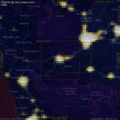
» NASA, Earths city lights 1995
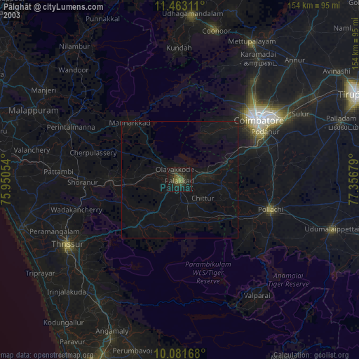
» NASA city lights 2003
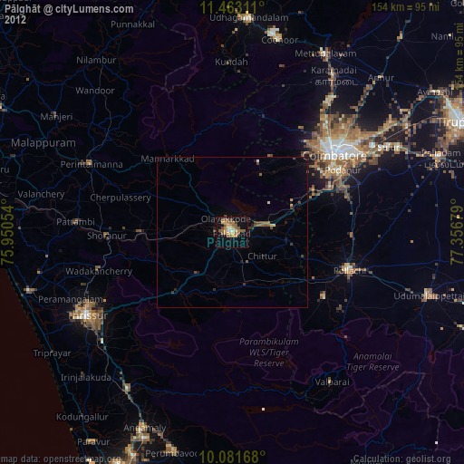
» Earth at Night: Flat Maps 2012, 2016