Mangaldai night lights from space
Night Light of Mangaldai (Assam) from space (India) Src. Average luminocity for 10x10km area is 17.9659% and for 50x50km: 6.8348%.
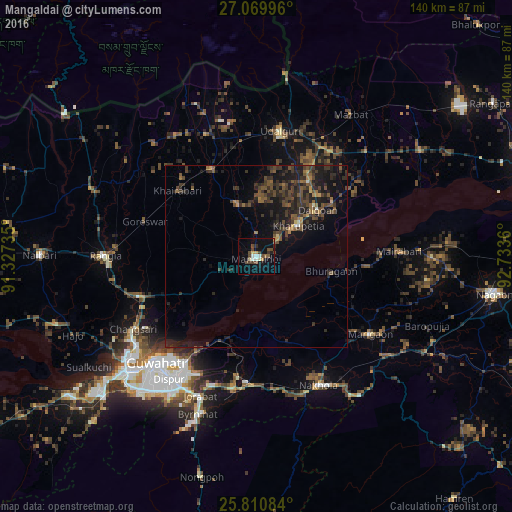
Analysis of Mangaldai night lights 2016
Square area 10x10 km:
 0.95%
0.95%90-99
3.6%80-89
1.33%70-79
1.33%60-69
0.76%50-59
2.27%40-49
8.33%30-39
1.7%20-29
0.95%10-19
15.15%0-9
63.64%Square area 50x50 km:
0.06%90-99
0.31%80-89
0.28%70-79
0.42%60-69
0.76%50-59
1.58%40-49
2.41%30-39
2.82%20-29
3.2%10-19
7.11%0-9
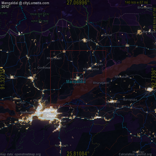
81.04%Clear (daylight) street map image can be seen on geolist.org.
Map coordinates:
27° 4' 11.9" North, 91° 19' 38.5" East
26° 26' 31.6" North, 92° 1' 49.7" East
25° 48' 39" North, 92° 44' 1" East
Some cities around Mangaldai sort by population:
• Guwahati
40.3 km =25 mi,  224°
224°
• Rangia
41.5 km =25.8 mi,  271°
271°
• Dhing
44.2 km =27.5 mi,  86°
86°
• Morigaon
38.2 km =23.7 mi,  124°
124°
• Khārupatia
14.4 km =8.9 mi,  53°
53°
• North Guwāhāti
41.2 km =25.6 mi,  228°
228°
• Udalguri
35.4 km =22 mi,  11°
11°
• Dispur
41.1 km =25.5 mi,  213°
213°
1263787 (p: 24,871)
Sources (retrieved 2019-11-25):
» Earth at Night: Flat Maps 2012, 2016