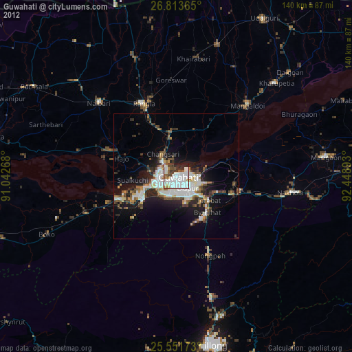
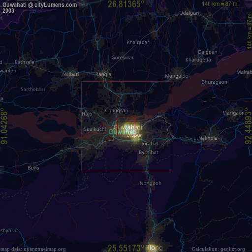
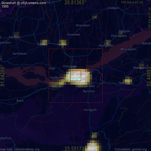
Guwahati night lights from space
Night Light of Guwahati (Assam) from space (India) Src. Average luminocity for 10x10km area is 80.4206% and for 50x50km: 20.4577%.
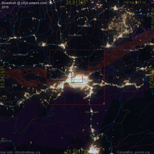
Analysis of Guwahati night lights 2016
Square area 10x10 km:
 23.41%
90-99
33.13%80-89
7.54%70-79
4.96%60-69
7.54%50-59
8.33%40-49
5.36%30-39
4.37%20-29
5.36%10-19
0%0-9
0%Square area 50x50 km:
3.64%90-99
5.49%80-89
1.48%70-79
1.46%60-69
1.92%50-59
2.61%40-49
3.06%30-39
3.44%20-29
6.21%10-19
10.4%0-9
60.3%Clear (daylight) street map image can be seen on geolist.org.
Map coordinates:
26° 48' 49.1" North, 91° 2' 33.6" East
26° 11' 3.8" North, 91° 44' 44.9" East
25° 33' 6.2" North, 92° 26' 56.1" East
Some cities around Guwahati sort by population:
• Rangia
32.3 km =20.1 mi,  335°
335°
• Mangaldai
40.3 km =25 mi,  44°
44°
• Khārupatia
54.6 km =33.9 mi,  47°
47°
• North Guwāhāti
2.9 km =1.8 mi,  299°
299°
• Hājo
23 km =14.3 mi,  287°
287°
• Nongpoh
34 km =21.1 mi,  157°
157°
• Soalkuchi
17.5 km =10.9 mi,  264°
264°
• Dispur
7.7 km =4.8 mi,  134°
134°
1271476 (p: 899,094)
Sources (retrieved 2019-11-25):
» NASA, Earths city lights 1995
» NASA city lights 2003
» Earth at Night: Flat Maps 2012, 2016