Manalūrpettai night lights from space
Night Light of Manalūrpettai (Tamil Nadu) from space (India) Src. Average luminocity for 10x10km area is 3.8264% and for 50x50km: 5.2843%.
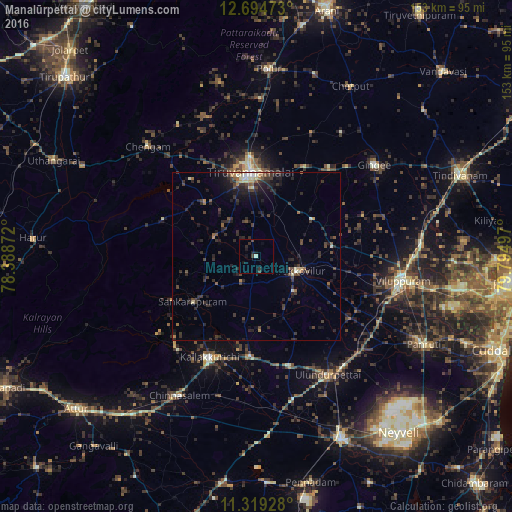
Analysis of Manalūrpettai night lights 2016
Square area 10x10 km:
 0%
0%90-99
0.83%80-89
0%70-79
0%60-69
0%50-59
0%40-49
1.65%30-39
2.27%20-29
1.03%10-19
4.13%0-9
90.08%Square area 50x50 km:
0.14%90-99
0.59%80-89
0.32%70-79
0.36%60-69
0.47%50-59
0.76%40-49
1.31%30-39
1.95%20-29
2.94%10-19
3.35%0-9
87.8%Clear (daylight) street map image can be seen on geolist.org.
Map coordinates:
12° 41' 41" North, 78° 23' 19.4" East
12° 0' 28.4" North, 79° 5' 30.6" East
11° 19' 9.4" North, 79° 47' 41.9" East
Some cities around Manalūrpettai sort by population:
• Tiruvannāmalai
24.4 km =15.2 mi,  355°
355°
• Villupuram
44.2 km =27.5 mi,  99°
99°
• Kallakkurichchi
33.1 km =20.6 mi,  205°
205°
• Tirukkoyilur
12.9 km =8 mi,  111°
111°
• Gingee
44.6 km =27.7 mi,  52°
52°
• Vettavalam
20 km =12.4 mi,  56°
56°
• Alagāpuram
23.2 km =14.4 mi,  234°
234°
• Pennāthur
30.3 km =18.8 mi,  28°
28°
1263966 (p: 7,626)
Sources (retrieved 2019-11-25):
» Earth at Night: Flat Maps 2012, 2016